
Magnitude |
2.7 |
| Date & Time (UTC) | 2013-01-29 10:51:41.7 |
| Date & Time (Local) | 1391/11/10 14:21:41.7 |
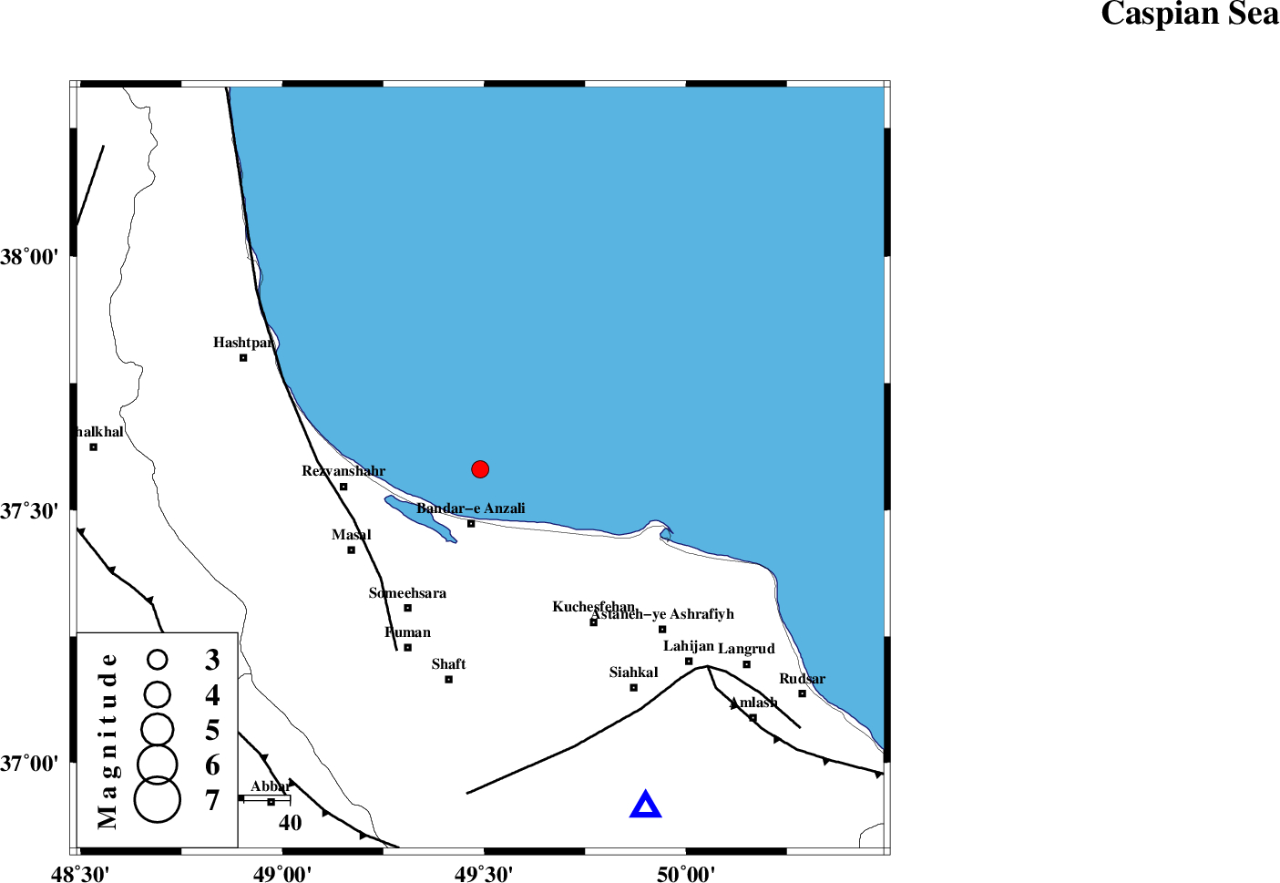
| Location | Lat:37.58 Lon: 49.49 |
| Region | Caspian Sea, 12 km North of Bandar-e anzali |
Nearest Cities |
|
| 12 km North of Bandar-e anzali, Gilan Province | |
| 22 km North West of Chaparkhaneh, Gilan Province | |
| 23 km North East of Kaporchal, Gilan Province | |
| 26 km North West of Khomam, Gilan Province | |
| 27 km North West of Jokam, Gilan Province | |
| Depth | 14 km |
| Agency | |
Faults within 150 km: |
|
| TALESH_F (Length: 258 km) , Distance to epicenter: 30 km | |
| LAHIJAN_F (Length: 92 km) , Distance to epicenter: 63 km | |
| KHAZAR_F (Length: 523 km) , Distance to epicenter: 66 km | |
| Number of Phases | 4 |
| RMS | 0.1 |
| Number of Stations | 3 |
| Error in Latitude | >3.1 km |
| Error in Longitude | 7.4 km |
| Error in Depth | 8.2 km |
Download waveform in seisan format
to download seisan software Click here
to access information about IIEES stations Click here
Amplitude | ||||||||
| UID | Agency | Station | Component | Amplitude | Period | Arrival Time | Proccessing Time | Signal Clip |
| 87757 | IIEES | ZNJK | E | 124.5 | 0.36 | 2013-01-29 10:52:22 | 2013-01-29 12:07:00 | n |
| 87758 | IIEES | GRMI | N | 83.4 | 0.48 | 2013-01-29 10:52:41 | 2013-01-29 12:07:00 | n |
| 87759 | IIEES | GRMI | E | 68.5 | 0.48 | 2013-01-29 10:52:44 | 2013-01-29 12:07:00 | n |
Phase | ||||||||||||
| Agency | Station | Component | Phase Type | Phase Quality | First Motion | Observed Arrival Time | Time Residual | Loc. Flag | Input Weight | Distance | Azimuth | |
| IIEES | ZNJK | Z | Pg | E | 2013-01-29 10:52:02 | 0.01 | y | 124 | 215 | |||
| IIEES | GRMI | Z | Pn | E | 2013-01-29 10:52:13 | 0.13 | y | 195 | 315 | |||
| IIEES | GRMI | E | Sg | E | 2013-01-29 10:52:37 | -0.08 | y | 195 | 315 | |||
| IIEES | CHTH | Z | Pn | E | 2013-01-29 10:52:18 | -0.05 | y | 236 | 141 | |||