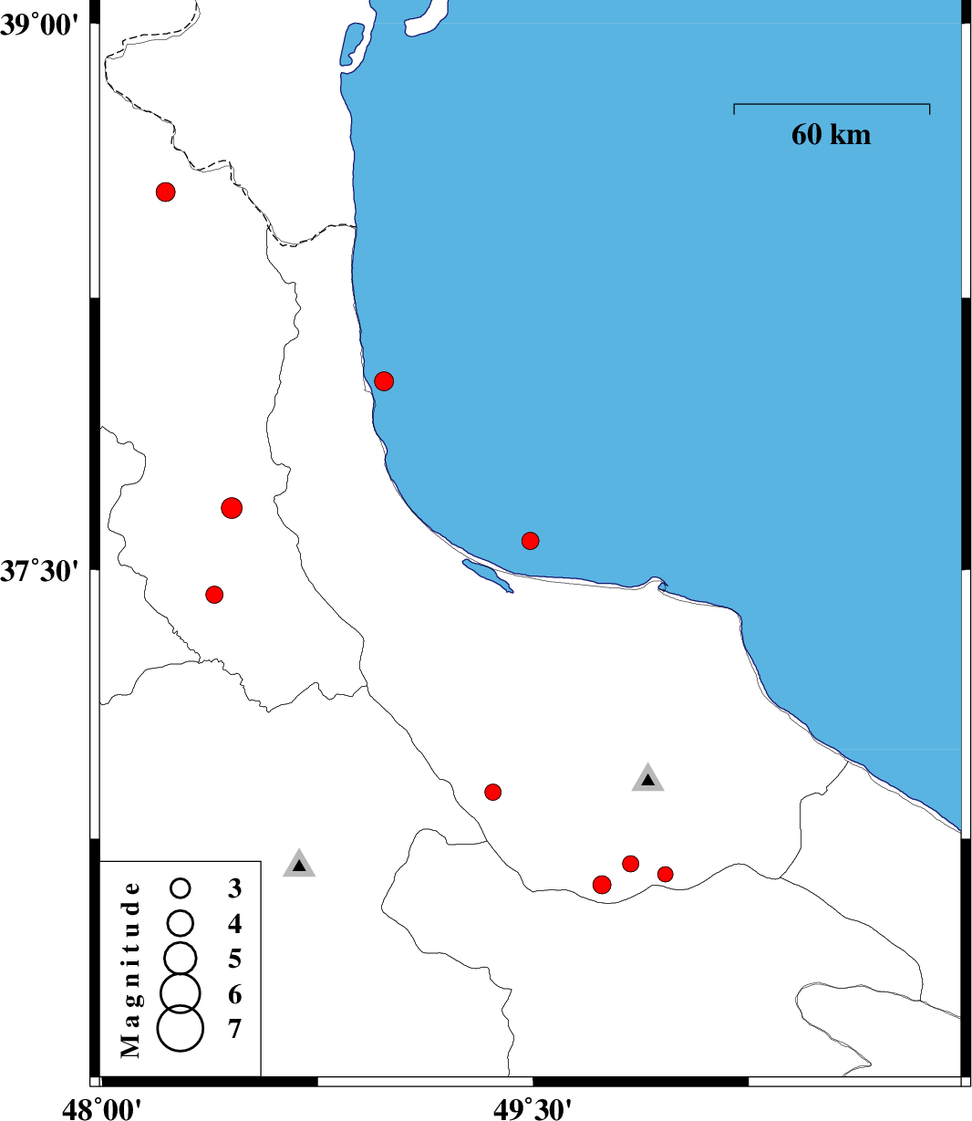
| Prel. Rep. | Date | Time(UTC) | Time(Local) | Lat. | Lon. | Depth | Mag. | Region | Waveform |
|
|
2013/01/29
|
10:51:41.7
|
14:21:41.7
| 37.58 | 49.49 | 14 |
ML:2.7
|
Caspian Sea, 12 km North of Bandar-e anzali | |
|
|
2013/01/24
|
01:30:35.8
|
05:00:35.8
| 36.62 | 49.74 | 37 |
ML:2.8
|
Gilan Province, 36 km South-East of Rudbar | |
|
|
2013/01/23
|
20:52:08.8
|
00:22:08.8
| 38.02 | 48.98 | 14 |
ML:3
|
Caspian Sea, 25 km North of Hashtpar | |
|
|
2013/01/17
|
01:11:03.7
|
04:41:03.7
| 38.54 | 48.22 | 18 |
ML:2.9
|
Ardebil Province, 23 km West of Namin | |
|
|
2013/01/16
|
17:52:07.9
|
21:22:07.9
| 36.65 | 49.96 | 14 |
ML:2.4
|
Gilan Province, 42 km North of Qazvin | |
|
|
2013/01/14
|
01:32:01.7
|
05:02:01.7
| 36.88 | 49.36 | 18 |
ML:2.6
|
Gilan Province, 9 km Rudbar | |
|
|
2013/01/04
|
16:10:08.2
|
19:40:08.2
| 36.68 | 49.84 | 14 |
ML:2.5
|
Gilan Province, 52 km South of Siahkal | |
|
|
2013/01/03
|
02:26:41.6
|
05:56:41.6
| 37.43 | 48.39 | 14 |
ML:2.7
|
Ardebil Province, 30 km South of Givi | |
|
|
2012/12/30
|
06:41:18.1
|
10:11:18.1
| 37.67 | 48.45 | 14 |
ML:3.2
|
Ardebil Province, 6 km Givi | |