
Magnitude |
3.1 |
| Date & Time (UTC) | 2013-02-22 07:38:19.7 |
| Date & Time (Local) | 1391/12/4 11:08:19.7 |
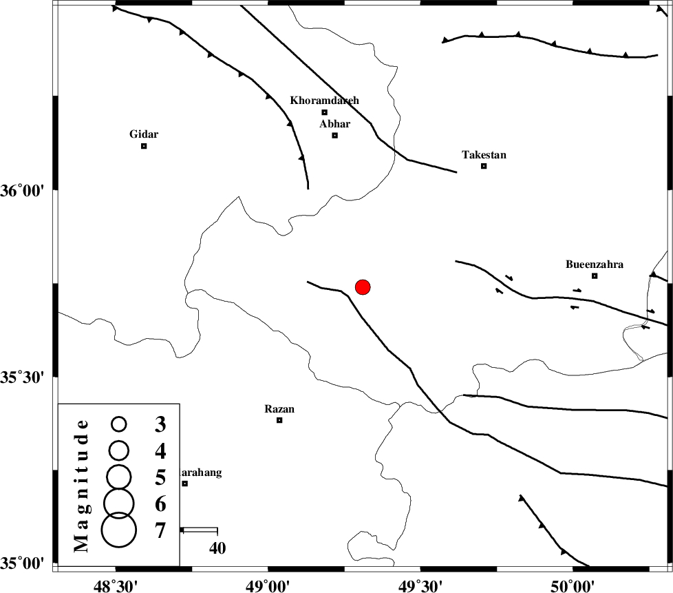
| Location | Lat:35.74 Lon: 49.31 |
| Region | Ghazvin Province, 45 km South of Abhar |
Nearest Cities |
|
| 3 km of Ab-e garm, Ghazvin Province | |
| 14 km of Hoseynabad, Ghazvin Province | |
| 18 km North of Avaj, Ghazvin Province | |
| 20 km North West of Kolanjin, Ghazvin Province | |
| 28 km South West of Nahavand, Ghazvin Province | |
| Depth | 15 km |
| Agency | |
Faults within 150 km: |
|
| KUSHK_E_NOSRAT_F (Length: 230 km) , Distance to epicenter: 5 km | |
| IPAK_F (Length: 80 km) , Distance to epicenter: 29 km | |
| SOLTANIYEH_F (Length: 119 km) , Distance to epicenter: 33 km | |
| Number of Phases | 6 |
| RMS | 0.2 |
| Number of Stations | 6 |
| Error in Latitude | >2.8 km |
| Error in Longitude | 2.6 km |
| Error in Depth | 5.5 km |
Download waveform in seisan format
to download seisan software Click here
to access information about IIEES stations Click here
Amplitude | ||||||||
| UID | Agency | Station | Component | Amplitude | Period | Arrival Time | Proccessing Time | Signal Clip |
| 87997 | IIEES | SNGE | N | 188.5 | 0.44 | 2013-02-22 07:39:16 | 2013-02-22 08:05:00 | n |
Phase | ||||||||||||
| Agency | Station | Component | Phase Type | Phase Quality | First Motion | Observed Arrival Time | Time Residual | Loc. Flag | Input Weight | Distance | Azimuth | |
| IIEES | ZNJK | Z | Pg | E | 2013-02-22 07:38:39 | 0.08 | y | 117 | 332 | |||
| IIEES | THKV | Z | Pg | E | 2013-02-22 07:38:43 | -0.04 | y | 143 | 82 | |||
| IIEES | ASAO | Z | Pg | E | 2013-02-22 07:38:44 | -0.17 | y | 148 | 153 | |||
| IIEES | CHTH | Z | Pg | E | 2013-02-22 07:38:46 | -0.25 | y | 166 | 83 | |||
| IIEES | SNGE | Z | Pg | E | 2013-02-22 07:38:51 | -0.11 | y | 192 | 248 | |||
| IIEES | GHVR | Z | Pn | E | 2013-02-22 07:38:55 | 0.49 | y | 226 | 128 | |||