
Magnitude |
2.6 |
| Date & Time (UTC) | 2013-03-26 16:27:11.5 |
| Date & Time (Local) | 1392/1/6 20:57:11.5 |
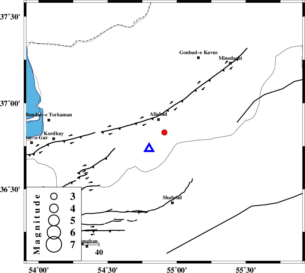
| Location | Lat:36.83 Lon: 54.91 |
| Region | Golestan Province, 10 km Ali Abad |
Nearest Cities |
|
| 9 km of Ali Abad, Golestan Province | |
| 21 km South of Khanbebin, Golestan Province | |
| 27 km South West of Deland, Golestan Province | |
| 28 km North West of Qaleh-ye nokharqan, Semnan Province | |
| 29 km South West of Ramian, Golestan Province | |
| Depth | 14 km |
| Agency | |
Faults within 150 km: |
|
| KHAZAR_F (Length: 523 km) , Distance to epicenter: 20 km | |
| SHAVAR_F (Length: 87 km) , Distance to epicenter: 20 km | |
| ASTANEH_F (Length: 72 km) , Distance to epicenter: 47 km | |
| Number of Phases | 5 |
| RMS | 0.2 |
| Number of Stations | 3 |
| Error in Latitude | >3.7 km |
| Error in Longitude | 8.7 km |
| Error in Depth | 8.2 km |
Download waveform in seisan format
to download seisan software Click here
to access information about IIEES stations Click here
Amplitude | ||||||||
| UID | Agency | Station | Component | Amplitude | Period | Arrival Time | Proccessing Time | Signal Clip |
| 88323 | IIEES | MRVT | E | 97.6 | 0.44 | 2013-03-26 16:27:54 | 2013-03-26 05:09:00 | n |
Phase | ||||||||||||
| Agency | Station | Component | Phase Type | Phase Quality | First Motion | Observed Arrival Time | Time Residual | Loc. Flag | Input Weight | Distance | Azimuth | |
| IIEES | SHRO | Z | Pg | E | 2013-03-26 16:27:33 | -0.18 | y | 134 | 132 | |||
| IIEES | MRVT | Z | Pg | E | 2013-03-26 16:27:34 | -0.05 | y | 140 | 48 | |||
| IIEES | MRVT | E | Sg | E | 2013-03-26 16:27:51 | -0.29 | y | 140 | 48 | |||
| IIEES | BJRD | Z | Pn | E | 2013-03-26 16:27:49 | 0.32 | y | 242 | 66 | |||
| IIEES | BJRD | E | Sg | E | 2013-03-26 16:28:20 | 0.2 | y | 242 | 66 | |||