| Prel. Rep. | Date | Time(UTC) | Time(Local) | Lat. | Lon. | Depth | Mag. | Region | Waveform |
|
|
2013/03/26
|
16:27:11.5
|
20:57:11.5
| 36.83 | 54.91 | 14 |
ML:2.6
|
Golestan Province, 10 km Ali Abad | |
|
|
2013/03/25
|
13:39:24.0
|
18:09:24.0
| 37.13 | 55.48 | 14 |
ML:2.2
|
Golestan Province, 14 km South of Minodasht | |
|
|
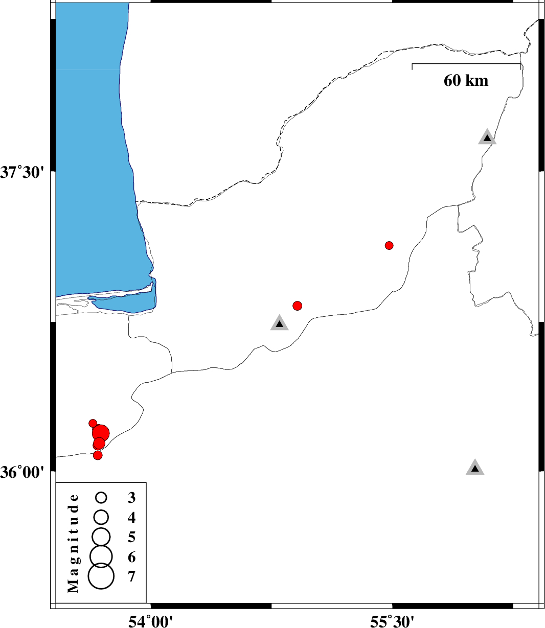
2013/03/22
|
20:53:15.8
|
01:23:15.8
| 36.08 | 53.67 | 18 |
ML:2.6
|
Semnan Province, 55 km East of Pol-E-Sefid | |
|
|
2013/03/22
|
04:11:26.2
|
08:41:26.2
| 36.14 | 53.68 | 14 |
ML:3.2
|
Mazandaran Province, 56 km East of Pol-E-Sefid | |
|
|
2013/03/22
|
04:02:50.2
|
08:32:50.2
| 36.13 | 53.67 | 18 |
ML:2.7
|
Mazandaran Province, 55 km East of Pol-E-Sefid | |
|
|
2013/03/21
|
19:37:04.7
|
23:07:04.7
| 36.19 | 53.69 | 14 |
ML:4.8
|
Mazandaran Province, 58 km South-East of Behshahr | |
|
|
2013/03/21
|
04:10:38.2
|
07:40:38.2
| 36.24 | 53.64 | 14 |
ML:2.2
|
Mazandaran Province, 51 km South of Behshahr | |
|
|
2013/03/20
|
18:09:53.4
|
21:39:53.4
| 36.21 | 53.67 | 15 |
ML:3
|
Mazandaran Province, 55 km South-East of Behshahr | |