
Magnitude |
1.8 |
| Date & Time (UTC) | 2013-03-29 16:47:13.5 |
| Date & Time (Local) | 1392/1/9 21:17:13.5 |
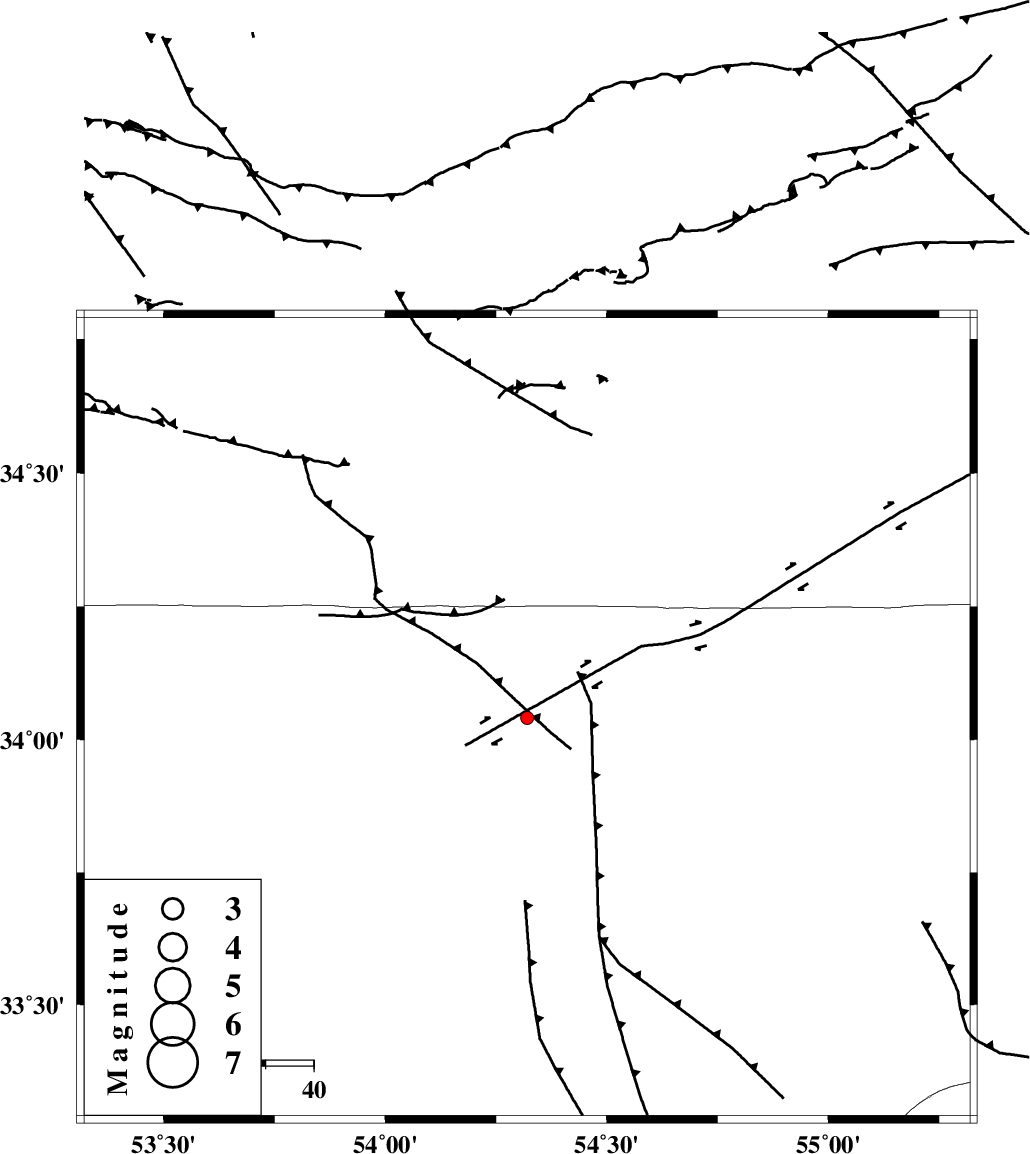
| Location | Lat:34.04 Lon: 54.32 |
| Region | Esfahan Province, 194 km North-East of Ardakan |
Nearest Cities |
|
| 9 km of Jondaq, Esfahan Province | |
| 47 km North of Chupanan, Esfahan Province | |
| 61 km North West of Farrokhi, Esfahan Province | |
| 77 km North West of Khur, Esfahan Province | |
| 98 km North West of Mehranjan, Esfahan Province | |
| Depth | 14 km |
| Agency | |
Faults within 150 km: |
|
| DORUNEH_F (Length: 713 km) , Distance to epicenter: 14 km | |
| BIABANAK_F (Length: 162 km) , Distance to epicenter: 80 km | |
| KUH_E_GUGERD_F (Length: 73 km) , Distance to epicenter: 126 km | |
| Number of Phases | 5 |
| RMS | 0.2 |
| Number of Stations | 3 |
| Error in Latitude | >4.8 km |
| Error in Longitude | 4.5 km |
| Error in Depth | 10.3 km |
Download waveform in seisan format
to download seisan software Click here
to access information about IIEES stations Click here
Amplitude | ||||||||
| UID | Agency | Station | Component | Amplitude | Period | Arrival Time | Proccessing Time | Signal Clip |
| 88359 | IIEES | YZKH | E | 8.2 | 0.4 | 2013-03-29 16:48:16 | 2013-03-30 02:19:00 | n |
| 88360 | IIEES | YZKH | N | 6.4 | 0.68 | 2013-03-29 16:48:20 | 2013-03-30 02:19:00 | n |
| 88361 | IIEES | TABS | E | 1.9 | 0.52 | 2013-03-29 16:48:30 | 2013-03-30 02:19:00 | n |
| 88362 | IIEES | TABS | N | 4 | 0.56 | 2013-03-29 16:48:36 | 2013-03-30 02:19:00 | n |
| 88363 | IIEES | GHVR | E | 9.2 | 0.56 | 2013-03-29 16:48:35 | 2013-03-30 02:19:00 | n |
| 88364 | IIEES | GHVR | N | 7.4 | 0.32 | 2013-03-29 16:48:35 | 2013-03-30 02:19:00 | n |
Phase | ||||||||||||
| Agency | Station | Component | Phase Type | Phase Quality | First Motion | Observed Arrival Time | Time Residual | Loc. Flag | Input Weight | Distance | Azimuth | |
| IIEES | YZKH | Z | Pg | E | 2013-03-29 16:47:44 | 0.18 | y | 185 | 172 | |||
| IIEES | YZKH | N | Sg | E | 2013-03-29 16:48:06 | -0.11 | y | 185 | 172 | |||
| IIEES | TABS | Z | Pn | E | 2013-03-29 16:47:53 | -0.17 | y | 262 | 99 | |||
| IIEES | GHVR | Z | Pn | E | 2013-03-29 16:47:57 | 0.32 | y | 288 | 281 | |||
| IIEES | GHVR | E | Sg | E | 2013-03-29 16:48:34 | -0.22 | y | 288 | 281 | |||