| Prel. Rep. | Date | Time(UTC) | Time(Local) | Lat. | Lon. | Depth | Mag. | Region | Waveform |
|
|
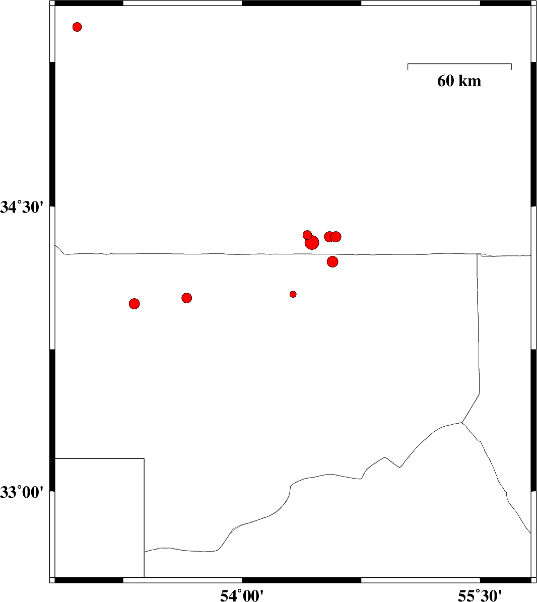
2013/03/29
|
16:47:13.5
|
21:17:13.5
| 34.04 | 54.32 | 14 |
ML:1.8
|
Esfahan Province, 194 km North-East of Ardakan | |
|
|
2013/03/24
|
14:52:02.5
|
19:22:02.5
| 33.99 | 53.32 | 14 |
ML:3
|
Esfahan Province, 126 km North-East of Nain | |
|
|
2013/03/16
|
05:53:32.3
|
09:23:32.3
| 34.34 | 54.59 | 14 |
ML:2.9
|
Semnan Province, 204 km South-East of Damghan | |
|
|
2013/03/15
|
11:17:51.3
|
14:47:51.3
| 34.21 | 54.57 | 14 |
ML:3.1
|
Esfahan Province, 219 km South-East of Damghan | |
|
|
2013/03/08
|
16:09:30.6
|
19:39:30.6
| 35.43 | 52.96 | 40 |
ML:2.6
|
Semnan Province, 40 km South-East of Firuzkuh | |
|
|
2013/03/05
|
12:29:51.2
|
15:59:51.2
| 34.34 | 54.55 | 15 |
ML:2.9
|
Semnan Province, 204 km South-East of Damghan | |
|
|
2013/03/05
|
05:20:54.5
|
08:50:54.5
| 34.35 | 54.41 | 18 |
ML:2.6
|
Semnan Province, 202 km South of Damghan | |
|
|
2013/03/04
|
09:47:53.7
|
13:17:53.7
| 34.31 | 54.44 | 15 |
ML:3.9
|
Semnan Province, 206 km South of Damghan | |
|
|
2013/02/28
|
02:15:50.8
|
05:45:50.8
| 34.02 | 53.65 | 14 |
ML:2.8
|
Esfahan Province, 138 km North-East of Nain | |