
Magnitude |
2.6 |
| Date & Time (UTC) | 2013-05-06 22:38:56.7 |
| Date & Time (Local) | 1392/2/17 03:08:56.7 |
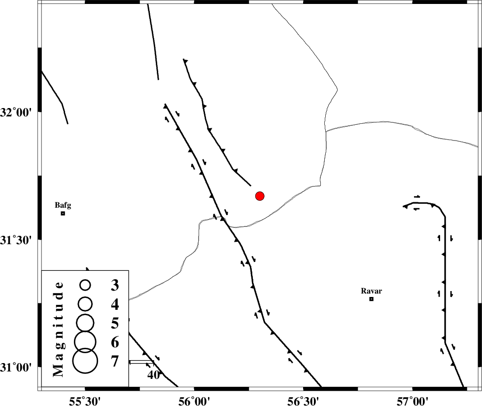
| Location | Lat:31.67 Lon: 56.3 |
| Region | Yazd Province, 66 km North-West of Ravar |
Nearest Cities |
|
| 7 km North of Asfih, Yazd Province | |
| 22 km East of Benestan, Yazd Province | |
| 28 km North of Kuhbanan, Kerman Province | |
| 34 km South East of Behabad, Yazd Province | |
| 34 km North of Jor, Kerman Province | |
| Depth | 14 km |
| Agency | |
Faults within 150 km: |
|
| JAFARABAD_F (Length: 60 km) , Distance to epicenter: 6 km | |
| KUHBANAN_F (Length: 189 km) , Distance to epicenter: 19 km | |
| LAKARKUH_F (Length: 138 km) , Distance to epicenter: 62 km | |
| Number of Phases | 5 |
| RMS | 0.1 |
| Number of Stations | 3 |
| Error in Latitude | >3.7 km |
| Error in Longitude | 1.8 km |
| Error in Depth | 6.7 km |
Download waveform in seisan format
to download seisan software Click here
to access information about IIEES stations Click here
Amplitude | ||||||||
| UID | Agency | Station | Component | Amplitude | Period | Arrival Time | Proccessing Time | Signal Clip |
| 89111 | IIEES | YZKH | N | 60 | 0.12 | 2013-05-06 22:39:53 | 2013-05-07 12:05:00 | n |
| 89112 | IIEES | YZKH | E | 68.5 | 0.44 | 2013-05-06 22:39:54 | 2013-05-07 12:05:00 | n |
Phase | ||||||||||||
| Agency | Station | Component | Phase Type | Phase Quality | First Motion | Observed Arrival Time | Time Residual | Loc. Flag | Input Weight | Distance | Azimuth | |
| IIEES | YZKH | Z | Pn | E | 2013-05-06 22:39:27 | 0.09 | y | 180 | 297 | |||
| IIEES | YZKH | E | Sg | E | 2013-05-06 22:39:48 | -0.06 | y | 180 | 297 | |||
| IIEES | TABS | Z | Pn | E | 2013-05-06 22:39:33 | 0.08 | y | 232 | 19 | |||
| IIEES | TABS | E | Sg | E | 2013-05-06 22:40:02 | 0 | y | 232 | 19 | |||
| IIEES | BSRN | Z | Pn | E | 2013-05-06 22:39:37 | -0.12 | y | 269 | 82 | |||