Home / Recent Earthquakes

| Prel. Rep. | Date | Time(UTC) | Time(Local) | Lat. | Lon. | Depth | Mag. | Region | Waveform |
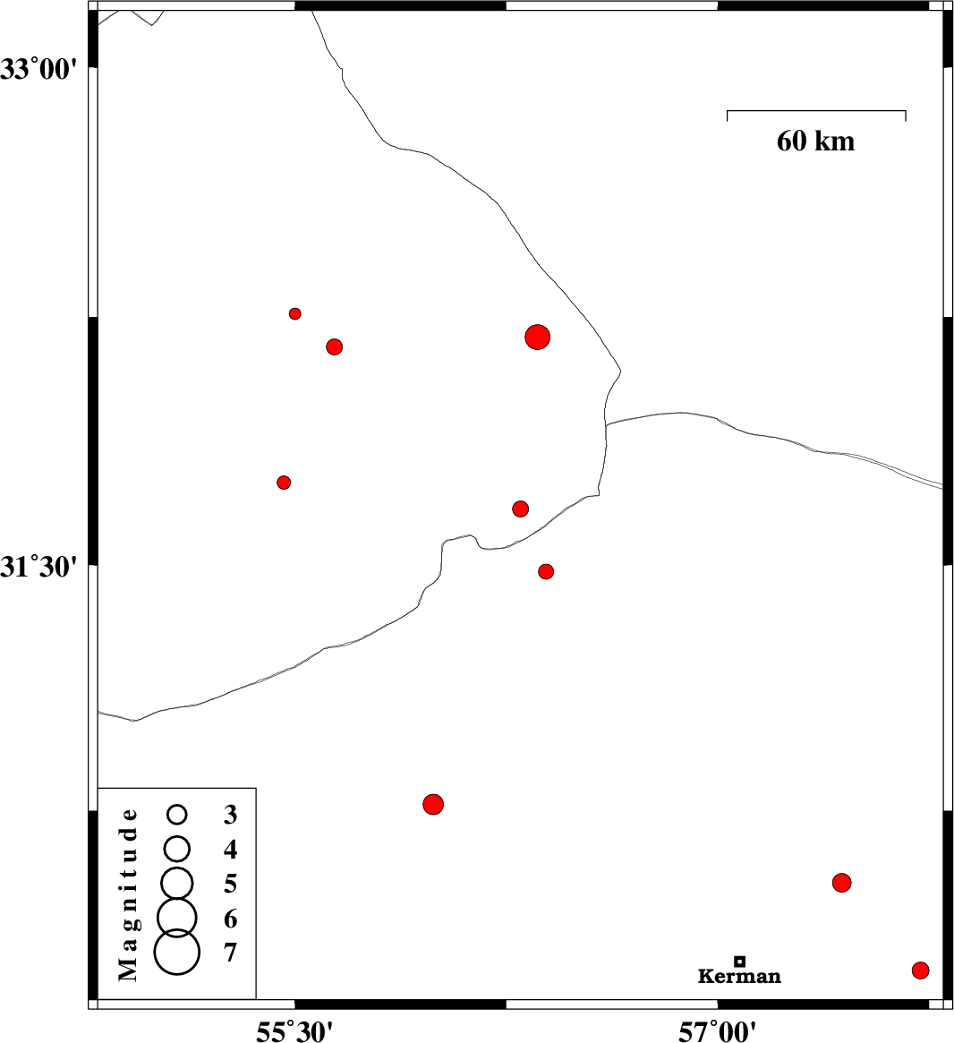
| 2013/05/06 | 22:38:56.7 | 03:08:56.7 | 31.67 | 56.3 | 14 | ML:2.6 | Yazd Province, 66 km North-West of Ravar | ||
| 2013/05/02 | 05:54:47.1 | 10:24:47.1 | 31.48 | 56.39 | 14 | ML:2.4 | Kerman Province, 47 km North-West of Ravar | ||
| 2013/04/27 | 03:22:20.5 | 07:52:20.5 | 30.53 | 57.44 | 16 | ML:2.9 | Kerman Province, 44 km North-East of Kerman | ||
| 2013/04/24 | 06:29:30.7 | 10:59:30.7 | 32.16 | 55.64 | 18 | ML:2.5 | Yazd Province, 66 km North-East of Bafq | ||
| 2013/04/23 | 20:52:50.8 | 01:22:50.8 | 32.19 | 56.36 | 14 | ML:4 | Yazd Province, 111 km North-West of Ravar | ||
| 2013/04/22 | 12:14:28.9 | 16:44:28.9 | 32.26 | 55.5 | 14 | ML:1.8 | Yazd Province, 73 km North-East of Bafq | ||
| 2013/04/19 | 22:34:41.4 | 03:04:41.4 | 30.26 | 57.72 | 14 | ML:2.7 | Kerman Province, 61 km East of Kerman | ||
| 2013/04/17 | 18:36:20.3 | 23:06:20.3 | 30.77 | 55.99 | 18 | ML:3.3 | Kerman Province, 41 km North of Rafsanjan | ||
| 2013/04/13 | 10:01:23.3 | 14:31:23.3 | 31.75 | 55.46 | 14 | ML:2.1 | Yazd Province, 17 km North of Bafq |