
Magnitude |
4.1 |
| Date & Time (UTC) | 2013-07-01 19:03:54.0 |
| Date & Time (Local) | 1392/4/10 23:33:54.0 |
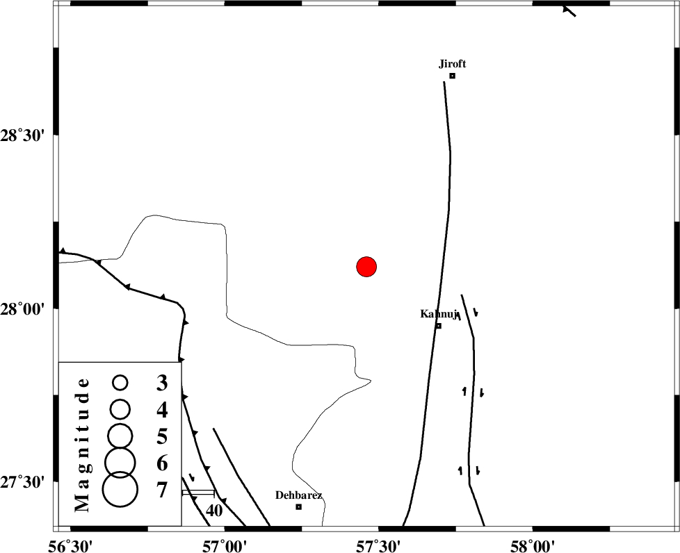
| Location | Lat:28.12 Lon: 57.46 |
| Region | Kerman Province, 30 km North-West of Kahnuj |
Nearest Cities |
|
| 6 km North of Mehrueye-e paeen, Kerman Province | |
| 14 km of Bolock, Kerman Province | |
| 16 km East of Hurpasefid, Kerman Province | |
| 20 km North East of Faryab, Kerman Province | |
| 30 km North West of Kahnuj, Kerman Province | |
| Depth | 15 km |
| Agency | |
Faults within 150 km: |
|
| SABZEVARAN_F (Length: 190 km) , Distance to epicenter: 25 km | |
| JIROFT_F (Length: 144 km) , Distance to epicenter: 32 km | |
| MAIN_ZAGROS_R_F (Length: 1106 km) , Distance to epicenter: 60 km | |
| Number of Phases | 4 |
| RMS | 0.1 |
| Number of Stations | 5 |
| Error in Latitude | >5.2 km |
| Error in Longitude | 1.2 km |
| Error in Depth | 0 km |
Download waveform in seisan format
to download seisan software Click here
to access information about IIEES stations Click here
Amplitude | ||||||||
| UID | Agency | Station | Component | Amplitude | Period | Arrival Time | Proccessing Time | Signal Clip |
| 89800 | IIEES | KRBR | E | 1681.9 | 0.36 | 2013-07-01 19:04:57 | 2013-07-01 08:37:00 | n |
Phase | ||||||||||||
| Agency | Station | Component | Phase Type | Phase Quality | First Motion | Observed Arrival Time | Time Residual | Loc. Flag | Input Weight | Distance | Azimuth | |
| IIEES | ZHSF | Z | Pn | E | 2013-07-01 19:04:46 | 0 | y | 363 | 62 | |||
| IIEES | GHIR | Z | Pn | E | 2013-07-01 19:04:56 | 0 | y | 439 | 273 | |||
| IIEES | BSRN | Z | P | E | 2013-07-01 19:04:58 | 0.09 | y | 456 | 20 | |||
| IIEES | SHRT | Z | P | E | 2013-07-01 19:05:24 | -0.14 | y | 670 | 23 | |||