
Magnitude |
1.2 |
| Date & Time (UTC) | 2013-09-14 01:36:45.5 |
| Date & Time (Local) | 1392/6/23 06:06:45.5 |
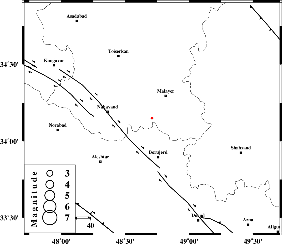
| Location | Lat:34.15 Lon: 48.71 |
| Region | Hamedan Province, 19 km South-West of Malayer |
Nearest Cities |
|
| 6 km North of Kahakdan, Hamedan Province | |
| 7 km of Saman, Hamedan Province | |
| 11 km North of Darre-ye gorg, Lorestan Province | |
| 13 km North East of Anuj, Hamedan Province | |
| 16 km North of Ashtarinan, Lorestan Province | |
| Depth | 15 km |
| Agency | |
Faults within 150 km: |
|
| NAHAVAND_F (Length: 102 km) , Distance to epicenter: 22 km | |
| DORUD (Length: 100 km) , Distance to epicenter: 39 km | |
| SAHANEH_F (Length: 77 km) , Distance to epicenter: 42 km | |
| Number of Phases | 3 |
| RMS | 0 |
| Number of Stations | 3 |
| Error in Latitude | >3.7 km |
| Error in Longitude | 2.4 km |
| Error in Depth | 0 km |
Download waveform in seisan format
to download seisan software Click here
to access information about IIEES stations Click here
Amplitude | ||||||||
| UID | Agency | Station | Component | Amplitude | Period | Arrival Time | Proccessing Time | Signal Clip |
| 90543 | IIEES | KHMZ | N | 5.4 | 0.3 | 2013-09-14 01:37:23 | 2013-09-14 03:21:00 | n |
| 90544 | IIEES | KHMZ | E | 4.1 | 0.12 | 2013-09-14 01:37:23 | 2013-09-14 03:21:00 | n |
| 90545 | IIEES | ASAO | E | 8.8 | 0.28 | 2013-09-14 01:37:24 | 2013-09-14 03:21:00 | n |
Phase | ||||||||||||
| Agency | Station | Component | Phase Type | Phase Quality | First Motion | Observed Arrival Time | Time Residual | Loc. Flag | Input Weight | Distance | Azimuth | |
| IIEES | KHMZ | Z | Pg | E | 2013-09-14 01:37:06 | 0.01 | y | 125 | 111 | |||
| IIEES | ASAO | Z | Pg | E | 2013-09-14 01:37:07 | -0.01 | y | 129 | 70 | |||
| IIEES | SNGE | Z | Pg | E | 2013-09-14 01:37:12 | 0.01 | y | 163 | 310 | |||