Home / Recent Earthquakes

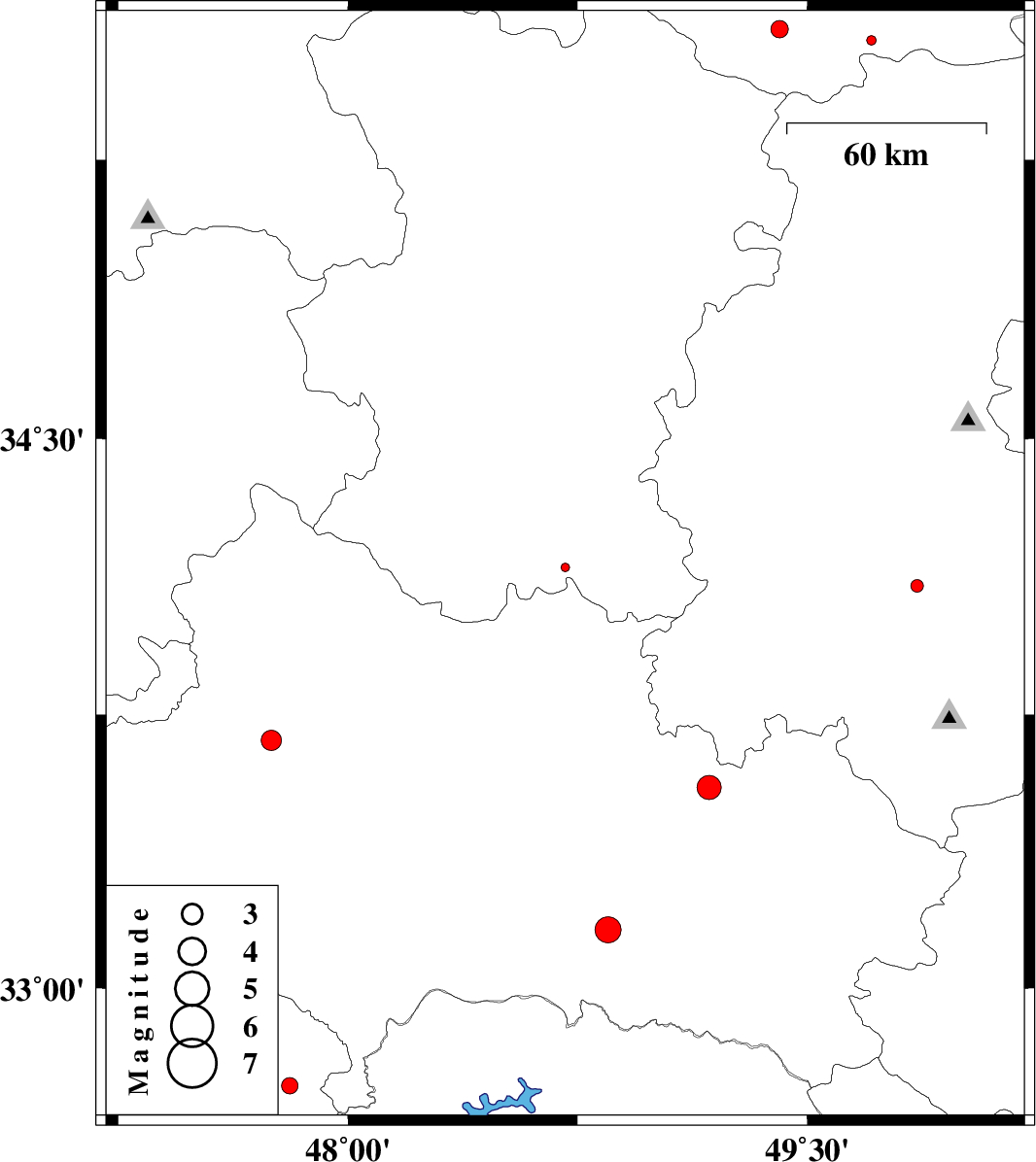
| Prel. Rep. | Date | Time(UTC) | Time(Local) | Lat. | Lon. | Depth | Mag. | Region | Waveform |
| 2013/09/14 | 01:36:45.5 | 06:06:45.5 | 34.15 | 48.71 | 15 | ML:1.2 | Hamedan Province, 19 km South-West of Malayer | ||
| 2013/09/13 | 00:25:49.9 | 04:55:49.9 | 33.16 | 48.85 | 14 | ML:3.8 | Lorestan Province, 41 km South-West of Dorud | ||
| 2013/09/10 | 15:29:45.1 | 19:59:45.1 | 33.68 | 47.75 | 18 | ML:3 | Lorestan Province, 21 km North-East of Kuhdasht | ||
| 2013/09/07 | 20:19:09.4 | 00:49:09.4 | 32.73 | 47.81 | 18 | ML:2.4 | Ilam Province, 48 km South of Pol-e dokhtar | ||
| 2013/09/03 | 20:04:58.5 | 00:34:58.5 | 33.55 | 49.18 | 14 | ML:3.5 | Lorestan Province, 12 km East of Dorud | ||
| 2013/08/28 | 18:04:53.3 | 22:34:53.3 | 35.6 | 49.41 | 14 | ML:2.5 | Ghazvin Province, 42 km North-East of Razan | ||
| 2013/08/26 | 21:34:30.6 | 02:04:30.6 | 35.57 | 49.71 | 46 | ML:1.4 | Ghazvin Province, 55 km South of Takestan | ||
| 2013/08/20 | 15:10:44.3 | 19:40:44.3 | 34.1 | 49.86 | 18 | ML:1.9 | Markazi Province, 16 km East of Arak |