
Magnitude |
3.9 |
| Date & Time (UTC) | 2014-02-03 05:33:57.6 |
| Date & Time (Local) | 1392/11/14 09:03:57.6 |
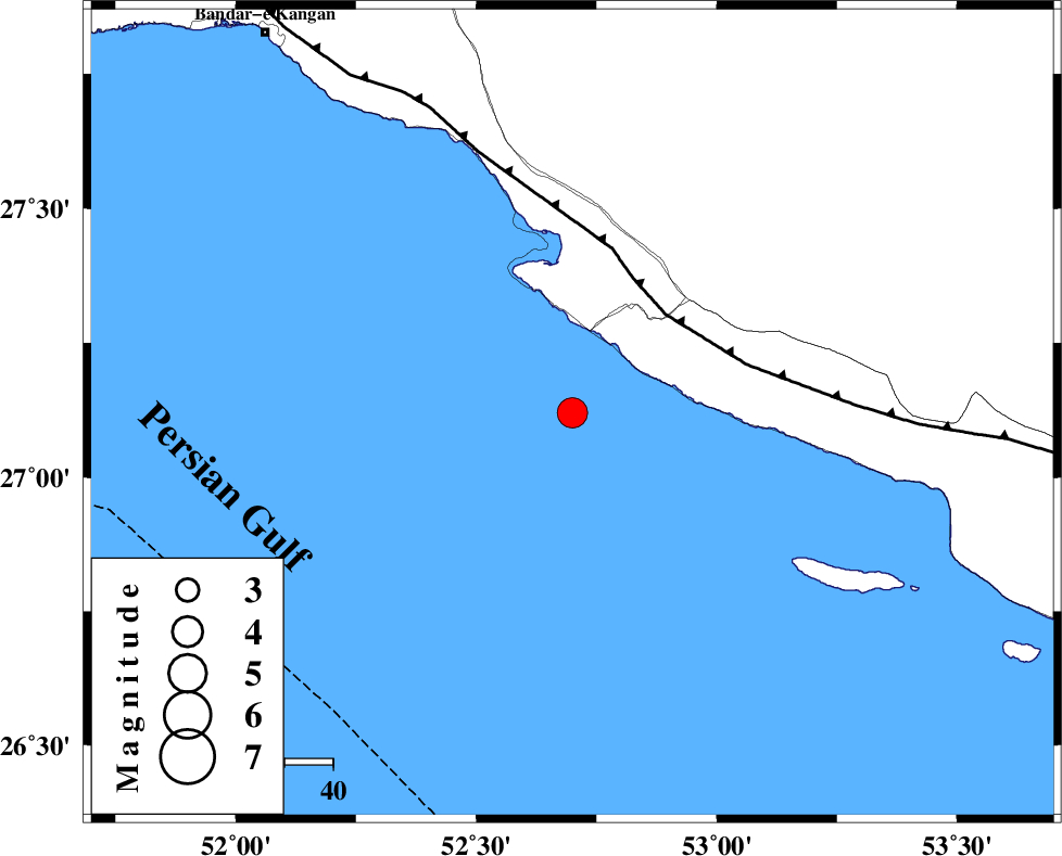
| Location | Lat:27.12 Lon: 52.7 |
| Region | Persian Gulf, 51 km South-West of Mehr |
Nearest Cities |
|
| 28 km South of Chah-e mobarak, Bushehr Province | |
| 40 km South of Bandar-e asaluyeh, Bushehr Province | |
| 45 km South West of Khoozi, Fars Province | |
| 51 km South West of Mehr, Fars Province | |
| 52 km South West of Lamerd, Fars Province | |
| Depth | 15 km |
| Agency | |
Faults within 150 km: |
|
| MFF3 (Length: 292 km) , Distance to epicenter: 28 km | |
| ZFF1 (Length: 165 km) , Distance to epicenter: 113 km | |
| LAR_F (Length: 99 km) , Distance to epicenter: 131 km | |
| Number of Phases | 7 |
| RMS | 0.3 |
| Number of Stations | 8 |
| Error in Latitude | >8.9 km |
| Error in Longitude | 2.1 km |
| Error in Depth | 0 km |
Download waveform in seisan format
to download seisan software Click here
to access information about IIEES stations Click here
Amplitude | ||||||||
| UID | Agency | Station | Component | Amplitude | Period | Arrival Time | Proccessing Time | Signal Clip |
| 91709 | IIEES | BNDS | N | 275.9 | 0.57 | 2014-02-03 05:35:48 | 2014-02-03 06:07:00 | n |
| 91710 | IIEES | KRBR | N | 90 | 0.37 | 2014-02-03 05:36:13 | 2014-02-03 06:07:00 | n |
| 91711 | IIEES | KRBR | E | 98.2 | 0.75 | 2014-02-03 05:36:14 | 2014-02-03 06:07:00 | n |
| 91712 | IIEES | GHVR | N | 16.4 | 0.31 | 2014-02-03 05:37:10 | 2014-02-03 06:07:00 | n |
Phase | ||||||||||||
| Agency | Station | Component | Phase Type | Phase Quality | First Motion | Observed Arrival Time | Time Residual | Loc. Flag | Input Weight | Distance | Azimuth | |
| IIEES | AHRM | Z | Pn | E | 2014-02-03 05:34:34 | 0.11 | y | 237 | 325 | |||
| IIEES | KRBR | Z | Pn | E | 2014-02-03 05:35:08 | 0.29 | y | 508 | 50 | |||
| IIEES | YZKH | Z | Pn | E | 2014-02-03 05:35:21 | -0.45 | y | 612 | 17 | |||
| IIEES | SHGR | Z | Pn | E | 2014-02-03 05:35:28 | 0.06 | y | 669 | 327 | |||
| IIEES | CHBR | Z | Pn | E | 2014-02-03 05:35:43 | -0.43 | y | 795 | 101 | |||
| IIEES | GHVR | Z | Pn | E | 2014-02-03 05:35:47 | -0.28 | y | 827 | 351 | |||
| IIEES | ZHSF | Z | Pn | E | 2014-02-03 05:35:49 | 0.48 | y | 838 | 69 | |||