Home / Recent Earthquakes

| Prel. Rep. | Date | Time(UTC) | Time(Local) | Lat. | Lon. | Depth | Mag. | Region | Waveform |
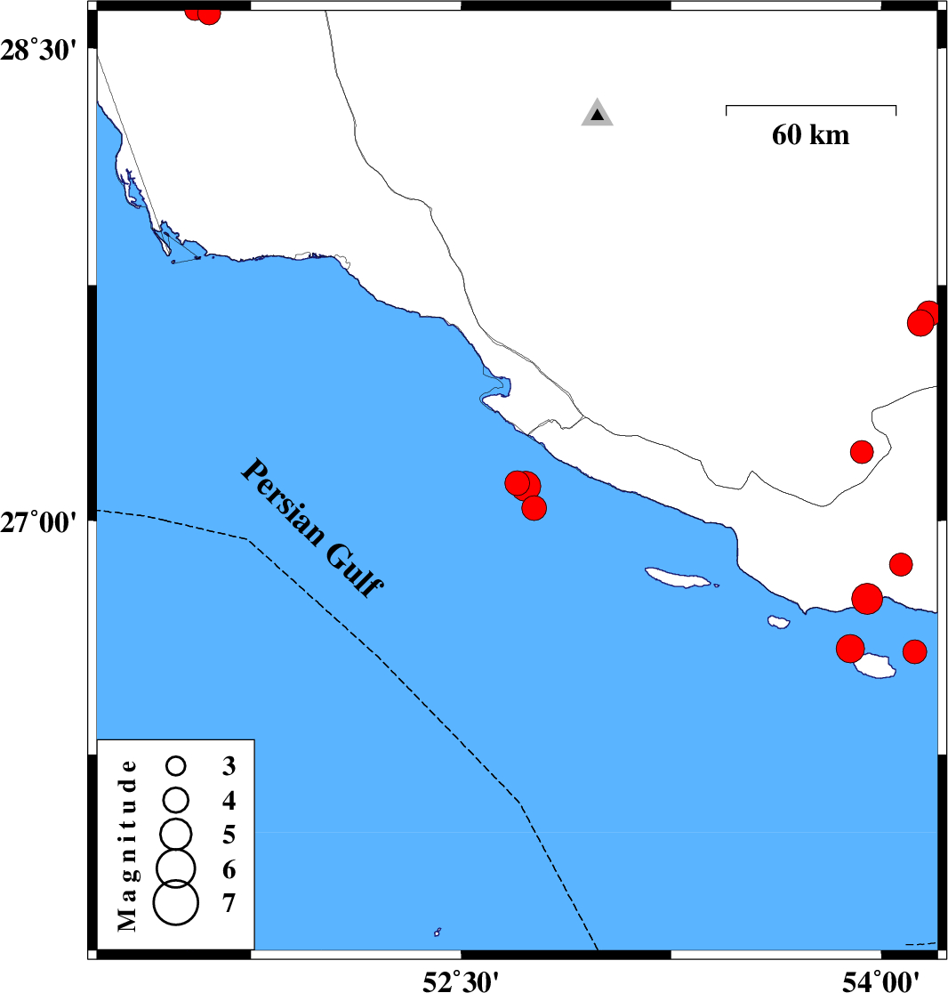
| 2014/02/03 | 19:33:43.9 | 23:03:43.9 | 27.04 | 52.76 | 15 | ML:3.9 | Persian Gulf, 58 km South-West of Mehr | ||
| 2014/02/03 | 18:10:08.6 | 21:40:08.6 | 28.61 | 51.6 | 30 | ML:3.6 | Bushehr Province, 23 km East of Khormog | ||
| 2014/02/03 | 05:33:57.6 | 09:03:57.6 | 27.12 | 52.7 | 15 | ML:3.9 | Persian Gulf, 51 km South-West of Mehr | ||
| 2014/02/02 | 10:29:05.1 | 13:59:05.1 | 27.11 | 52.73 | 15 | ML:4.8 | Persian Gulf, 51 km South-West of Mehr | ||
| 2014/01/22 | 03:32:07.5 | 07:02:07.5 | 27.63 | 54.14 | 15 | ML:4.2 | Fars Province, 21 km West of Lar | ||
| 2014/01/22 | 03:26:41.2 | 06:56:41.2 | 27.66 | 54.17 | 15 | ML:4.1 | Fars Province, 17 km West of Lar | ||
| 2014/01/18 | 12:33:30.6 | 16:03:30.6 | 27.22 | 53.93 | 46 | ML:3.7 | Fars Province, 43 km West of Bastak | ||
| 2014/01/11 | 21:02:18.8 | 00:32:18.8 | 26.86 | 54.07 | 14 | ML:3.6 | Hormozgan Province, 48 km South-West of Bastak | ||
| 2014/01/10 | 14:30:39.3 | 18:00:39.3 | 26.58 | 54.12 | 15 | ML:3.8 | Persian Gulf, 73 km West of Bandar-e lengeh | ||
| 2014/01/10 | 08:12:42.6 | 11:42:42.6 | 26.59 | 53.89 | 15 | ML:4.5 | Persian Gulf, 96 km West of Bandar-e lengeh | ||
| 2014/01/09 | 08:31:29.8 | 12:01:29.8 | 26.75 | 53.95 | 15 | ML:5 | Hormozgan Province, 64 km South-West of Bastak | ||
| 2014/01/06 | 23:18:23.1 | 02:48:23.1 | 28.62 | 51.55 | 14 | ML:3.2 | Bushehr Province, 18 km East of Khormog |