
Magnitude |
3.5 |
| Date & Time (UTC) | 2014-04-04 03:46:10.0 |
| Date & Time (Local) | 1393/1/15 08:16:10.0 |
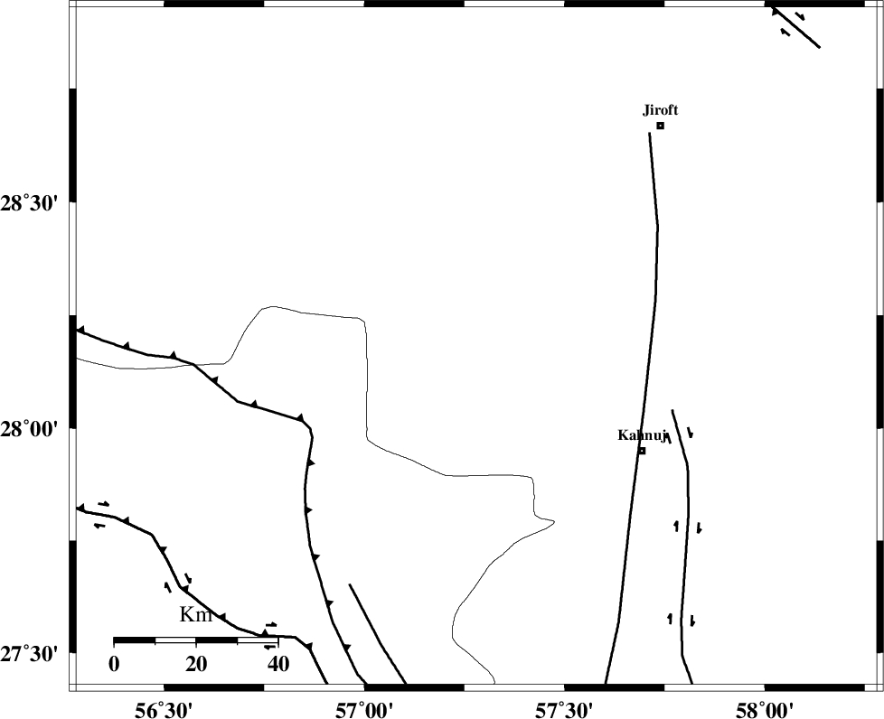
| Location | Lat:28.18 Lon: 57.28 |
| Region | Kerman Province, 48 km North-West of Kahnuj |
Nearest Cities |
|
| 4 km of Hurpasefid, Kerman Province | |
| 13 km North of Faryab, Kerman Province | |
| 16 km North West of Mehrueye-e paeen, Kerman Province | |
| 27 km West of Bolock, Kerman Province | |
| 40 km North of Fariab, Hormozgan Province | |
| Depth | 14 km |
| Agency | |
Faults within 150 km: |
|
| SABZEVARAN_F (Length: 190 km) , Distance to epicenter: 44 km | |
| MAIN_ZAGROS_R_F (Length: 1106 km) , Distance to epicenter: 46 km | |
| JIROFT_F (Length: 144 km) , Distance to epicenter: 50 km | |
| Number of Phases | 4 |
| RMS | 0.1 |
| Number of Stations | 3 |
| Error in Latitude | >5.8 km |
| Error in Longitude | 14.6 km |
| Error in Depth | 6.9 km |
Download waveform in seisan format
to download seisan software Click here
to access information about IIEES stations Click here
Amplitude | ||||||||
| UID | Agency | Station | Component | Amplitude | Period | Arrival Time | Proccessing Time | Signal Clip |
| 92144 | IIEES | KRBR | E | 365.4 | 0.64 | 2014-04-04 03:47:17 | 2014-04-04 08:11:00 | n |
| 92145 | IIEES | KRBR | N | 430.5 | 0.52 | 2014-04-04 03:47:18 | 2014-04-04 08:11:00 | n |
Phase | ||||||||||||
| Agency | Station | Component | Phase Type | Phase Quality | First Motion | Observed Arrival Time | Time Residual | Loc. Flag | Input Weight | Distance | Azimuth | |
| IIEES | KRBR | Z | Pg | E | 2014-04-04 03:46:43 | -0.16 | y | 207 | 346 | |||
| IIEES | KRBR | N | Sg | E | 2014-04-04 03:47:08 | 0.04 | y | 207 | 346 | |||
| IIEES | YZKH | Z | Pn | E | 2014-04-04 03:47:24 | 0.09 | y | 534 | 332 | |||
| IIEES | TABS | Z | Pn | E | 2014-04-04 03:47:33 | 0.12 | y | 607 | 359 | |||