
| Prel. Rep. | Date | Time(UTC) | Time(Local) | Lat. | Lon. | Depth | Mag. | Region | Waveform |
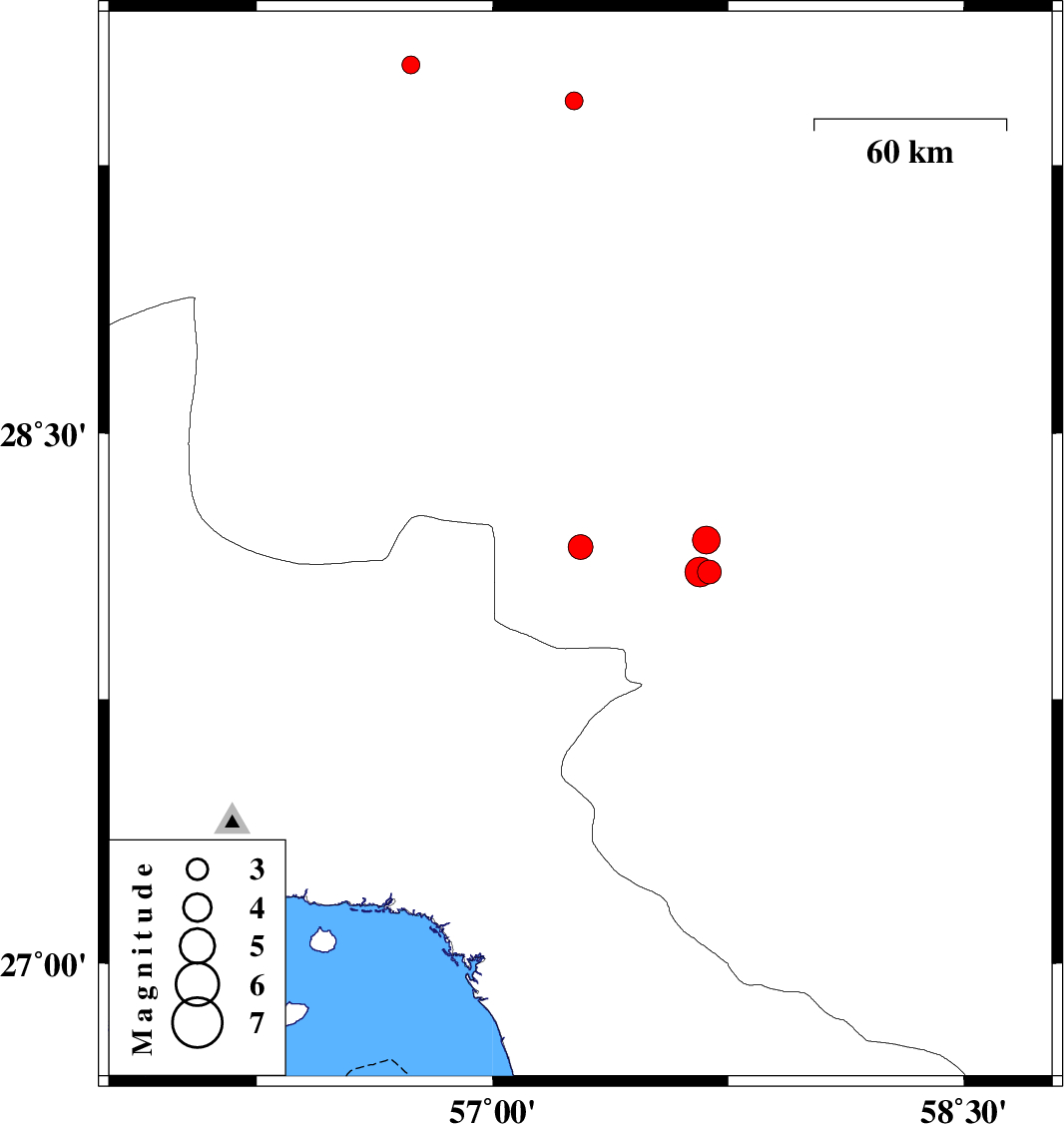
| 2014/04/04 | 03:46:10.0 | 08:16:10.0 | 28.18 | 57.28 | 14 | ML:3.5 | Kerman Province, 48 km North-West of Kahnuj | ||
| 2014/04/03 | 22:13:44.7 | 02:43:44.7 | 29.43 | 57.26 | 14 | ML:2.6 | Kerman Province, 67 km North-East of Baft | ||
| 2014/04/01 | 09:58:15.6 | 14:28:15.6 | 28.11 | 57.69 | 15 | ML:3.4 | Kerman Province, 18 km North of Kahnuj | ||
| 2014/04/01 | 06:40:19.4 | 11:10:19.4 | 28.2 | 57.68 | 14 | ML:4 | Kerman Province, 28 km North of Kahnuj | ||
| 2014/04/01 | 06:37:18.0 | 11:07:18.0 | 28.11 | 57.66 | 15 | ML:4.3 | Kerman Province, 18 km North of Kahnuj | ||
| 2014/03/30 | 06:45:38.8 | 11:15:38.8 | 29.53 | 56.74 | 12 | ML:2.5 | Kerman Province, 35 km North-East of Baft |

 IIEES All Rights Reserved