
Magnitude |
1.8 |
| Date & Time (UTC) | 2014-05-23 10:23:54.1 |
| Date & Time (Local) | 1393/3/2 14:53:54.1 |
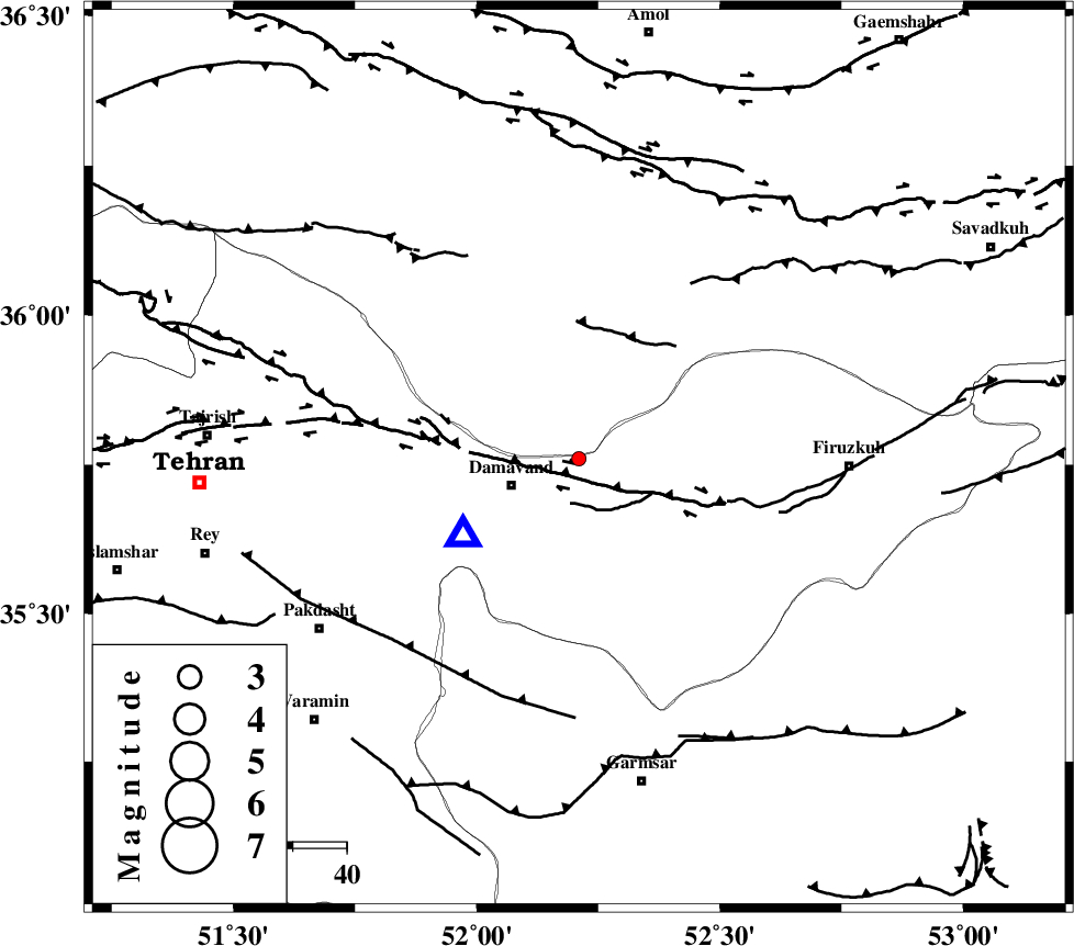
| Location | Lat:35.76 Lon: 52.21 |
| Region | Tehran Province, 13 km East of Damavand |
Nearest Cities |
|
| 13 km North East of Damavand, Tehran Province | |
| 15 km South of Rineh, Mazandaran Province | |
| 16 km North of Sarbandan, Tehran Province | |
| 16 km South of Gaznak, Mazandaran Province | |
| 17 km North of Mara, Tehran Province | |
| Depth | 16 km |
| Agency | |
Faults within 150 km: |
|
| MOSHA_F (Length: 234 km) , Distance to epicenter: 8 km | |
| N_TEHRAN_F4 (Length: 115 km) , Distance to epicenter: 39 km | |
| EYVANEKEY_F (Length: 74 km) , Distance to epicenter: 47 km | |
| Number of Phases | 5 |
| RMS | 0 |
| Number of Stations | 3 |
| Error in Latitude | >2 km |
| Error in Longitude | 2.8 km |
| Error in Depth | 2.6 km |
Download waveform in seisan format
to download seisan software Click here
to access information about IIEES stations Click here
Amplitude | ||||||||
| UID | Agency | Station | Component | Amplitude | Period | Arrival Time | Proccessing Time | Signal Clip |
| 92496 | IIEES | THKV | E | 21.4 | 0.56 | 2014-05-23 10:24:35 | 2014-05-23 04:23:00 | n |
Phase | ||||||||||||
| Agency | Station | Component | Phase Type | Phase Quality | First Motion | Observed Arrival Time | Time Residual | Loc. Flag | Input Weight | Distance | Azimuth | |
| IIEES | DAMV | Z | Pg | E | 2014-05-23 10:23:59 | -0.01 | y | 25.9 | 235 | |||
| IIEES | THKV | Z | Pg | E | 2014-05-23 10:24:14 | 0.03 | y | 121 | 278 | |||
| IIEES | THKV | E | Sg | E | 2014-05-23 10:24:29 | -0.02 | y | 121 | 278 | |||
| IIEES | ASAO | Z | Pn | E | 2014-05-23 10:24:31 | -0.01 | y | 240 | 236 | |||
| IIEES | ASAO | E | Sg | E | 2014-05-23 10:25:02 | 0.01 | y | 240 | 236 | |||