
Magnitude |
4.1 |
| Date & Time (UTC) | 2014-07-12 11:20:58.5 |
| Date & Time (Local) | 1393/4/21 15:50:58.5 |
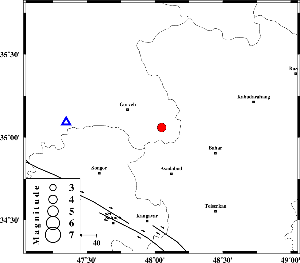
| Location | Lat:35.06 Lon: 48.05 |
| Region | Kurdistan Province, 25 km South-East of Qorveh |
Nearest Cities |
|
| 9 km North of Dezaj, Kurdistan Province | |
| 13 km North of Hasanabad, Hamedan Province | |
| 21 km East of Qaleh, Kurdistan Province | |
| 22 km North of Chenar olia, Hamedan Province | |
| 23 km South West of Goltappeh, Hamedan Province | |
| Depth | 18 km |
| Agency | |
Faults within 150 km: |
|
| NAHAVAND_F (Length: 102 km) , Distance to epicenter: 66 km | |
| DINEHVAR_F (Length: 46 km) , Distance to epicenter: 68 km | |
| SARTAKHT_F (Length: 78 km) , Distance to epicenter: 70 km | |
| Number of Phases | 6 |
| RMS | 0.2 |
| Number of Stations | 6 |
| Error in Latitude | >2.2 km |
| Error in Longitude | 7.5 km |
| Error in Depth | 6.3 km |
Download waveform in seisan format
to download seisan software Click here
to access information about IIEES stations Click here
Amplitude | ||||||||
| UID | Agency | Station | Component | Amplitude | Period | Arrival Time | Proccessing Time | Signal Clip |
| 92786 | IIEES | KHMZ | E | 633.9 | 0.76 | 2014-07-12 11:22:12 | 2014-07-12 12:43:00 | n |
| 92787 | IIEES | GHIR | E | 31.7 | 0.44 | 2014-07-12 11:24:26 | 2014-07-12 12:43:00 | n |
Phase | ||||||||||||
| Agency | Station | Component | Phase Type | Phase Quality | First Motion | Observed Arrival Time | Time Residual | Loc. Flag | Input Weight | Distance | Azimuth | |
| IIEES | ZNJK | Z | Pg | E | 2014-07-12 11:21:29 | 0.31 | y | 187 | 18 | |||
| IIEES | ZNJK | E | Sg | E | 2014-07-12 11:21:51 | -0.27 | y | 187 | 18 | |||
| IIEES | ASAO | Z | Pn | E | 2014-07-12 11:21:29 | 0.04 | y | 190 | 107 | |||
| IIEES | KHMZ | Z | Pg | E | 2014-07-12 11:21:35 | -0.16 | y | 229 | 129 | |||
| IIEES | GHVR | Z | Pg | E | 2014-07-12 11:21:47 | 0.16 | y | 300 | 102 | |||
| IIEES | SHGR | Z | Pn | E | 2014-07-12 11:21:47 | -0.08 | y | 335 | 168 | |||

 IIEES All Rights Reserved