
| Prel. Rep. | Date | Time(UTC) | Time(Local) | Lat. | Lon. | Depth | Mag. | Region | Waveform |
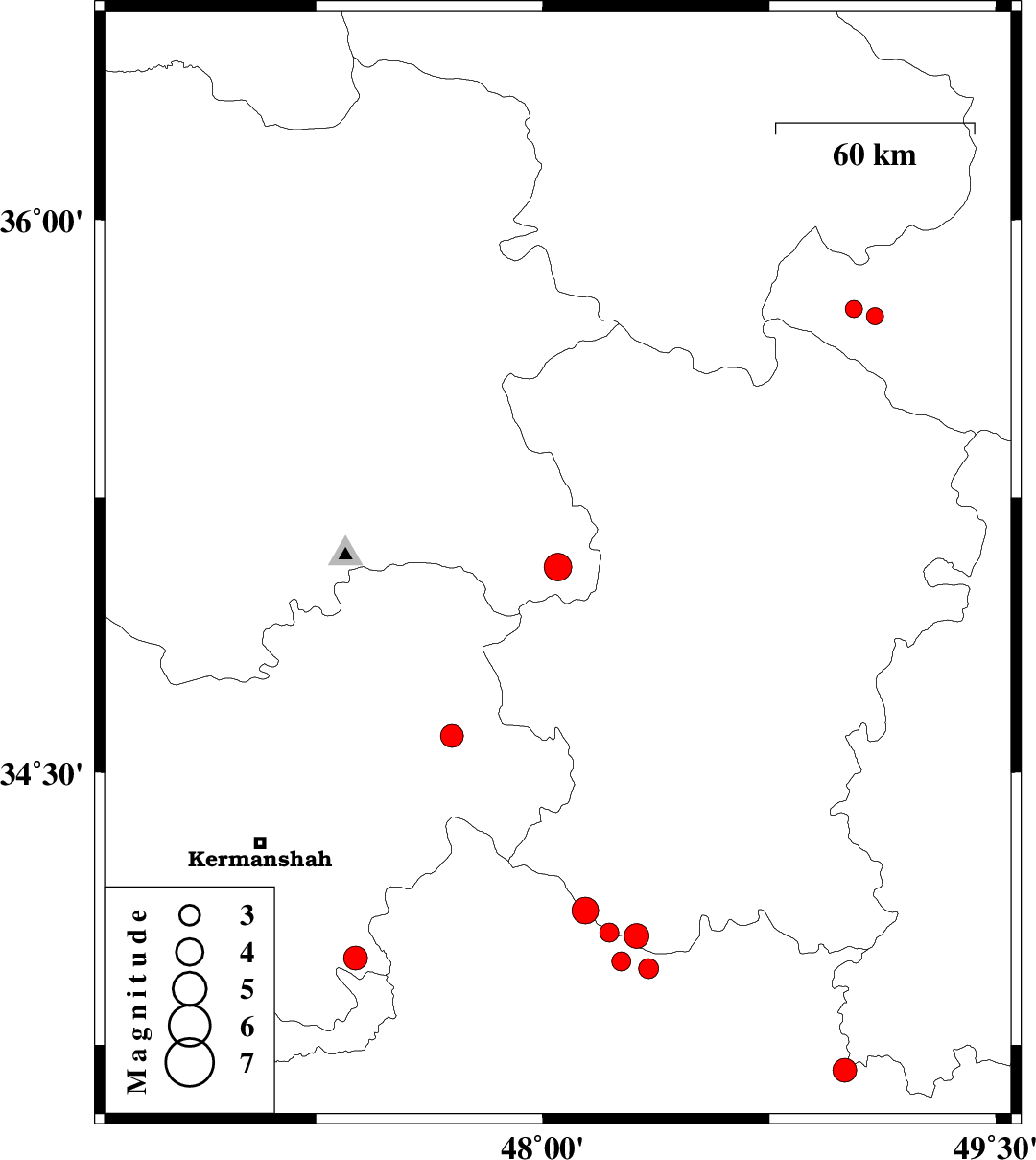
| 2014/07/12 | 11:20:58.5 | 15:50:58.5 | 35.06 | 48.05 | 18 | ML:4.1 | Kurdistan Province, 25 km South-East of Qorveh | ||
| 2014/06/29 | 02:12:54.6 | 06:42:54.6 | 33.96 | 48.35 | 14 | ML:3 | Lorestan Province, 12 km Aleshtar | ||
| 2014/06/29 | 01:25:46.7 | 05:55:46.7 | 34.06 | 48.22 | 14 | ML:2.8 | Lorestan Province, 23 km East of Nurabad | ||
| 2014/06/29 | 01:09:29.3 | 05:39:29.3 | 34.12 | 48.14 | 18 | ML:3.9 | Lorestan Province, 17 km East of Nurabad | ||
| 2014/06/25 | 00:01:34.0 | 04:31:34.0 | 34.05 | 48.31 | 17 | ML:3.7 | Hamedan Province, 20 km North of Aleshtar | ||
| 2014/06/24 | 23:50:02.0 | 04:20:02.0 | 33.98 | 48.26 | 17 | ML:2.8 | Lorestan Province, 13 km North of Aleshtar | ||
| 2014/06/21 | 03:11:07.2 | 07:41:07.2 | 33.68 | 49 | 14 | ML:3.5 | Lorestan Province, 23 km North of Dorud | ||
| 2014/06/18 | 13:39:06.9 | 18:09:06.9 | 34.6 | 47.7 | 14 | ML:3.4 | Kermanshah Province, 14 km North of Sahneh | ||
| 2014/06/18 | 06:19:40.9 | 10:49:40.9 | 33.99 | 47.38 | 17 | ML:3.5 | Kermanshah Province, 35 km South-West of Harsin | ||
| 2014/06/16 | 23:14:44.3 | 03:44:44.3 | 35.76 | 49.03 | 18 | ML:2.6 | Ghazvin Province, 42 km North of Razan | ||
| 2014/06/14 | 15:15:48.4 | 19:45:48.4 | 35.74 | 49.1 | 16 | ML:2.5 | Ghazvin Province, 40 km North of Razan |

 IIEES All Rights Reserved