
Magnitude |
3 |
| Date & Time (UTC) | 2014-12-21 09:42:44.1 |
| Date & Time (Local) | 1393/9/30 13:12:44.1 |
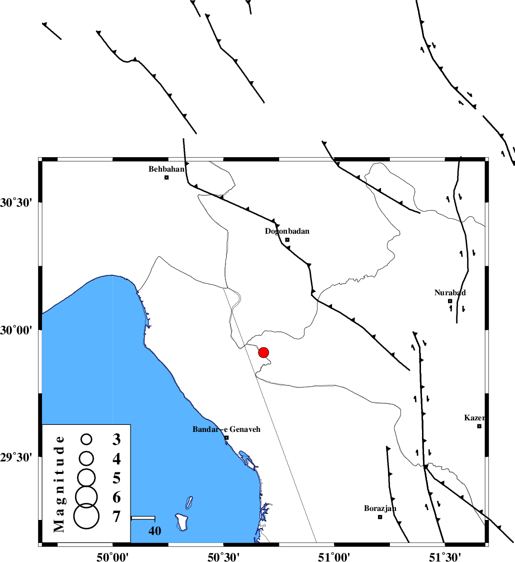
| Location | Lat:29.91 Lon: 50.68 |
| Region | Fars Province, 40 km North-East of Bandar-e genaveh |
Nearest Cities |
|
| 30 km North of Mohammad salehi, Bushehr Province | |
| 38 km South East of Siyahmakan-e bozorg, Bushehr Province | |
| 41 km North East of Bandar-e genaveh, Bushehr Province | |
| 41 km North East of Emamhasan, Bushehr Province | |
| 41 km North West of Chehar rustaee, Bushehr Province | |
| Depth | 14 km |
| Agency | |
Faults within 150 km: |
|
| ZFF3 (Length: 125 km) , Distance to epicenter: 9 km | |
| RAG_E_SEFID_F (Length: 84 km) , Distance to epicenter: 39 km | |
| MISHAN_F (Length: 76 km) , Distance to epicenter: 57 km | |
| Number of Phases | 6 |
| RMS | 0.1 |
| Number of Stations | 4 |
| Error in Latitude | >5.6 km |
| Error in Longitude | 6.9 km |
| Error in Depth | 13.4 km |
Download waveform in seisan format
to download seisan software Click here
to access information about IIEES stations Click here
Amplitude | ||||||||
| UID | Agency | Station | Component | Amplitude | Period | Arrival Time | Proccessing Time | Signal Clip |
| 94564 | IIEES | AHRM | N | 312.8 | 0.6 | 2014-12-21 09:43:26 | 2014-12-21 10:35:00 | n |
Phase | ||||||||||||
| Agency | Station | Component | Phase Type | Phase Quality | First Motion | Observed Arrival Time | Time Residual | Loc. Flag | Input Weight | Distance | Azimuth | |
| IIEES | AHRM | Z | Pg | E | 2014-12-21 09:43:05 | -0.13 | y | 130 | 152 | |||
| IIEES | AHRM | E | Sg | E | 2014-12-21 09:43:21 | 0.09 | y | 130 | 152 | |||
| IIEES | NASN | Z | Pn | E | 2014-12-21 09:43:39 | -0.02 | y | 379 | 32 | |||
| IIEES | KHMZ | Z | Pn | E | 2014-12-21 09:43:45 | 0.04 | y | 431 | 351 | |||
| IIEES | YZKH | Z | Pn | E | 2014-12-21 09:43:49 | 0.08 | y | 463 | 53 | |||
| IIEES | YZKH | N | S | E | 2014-12-21 09:44:37 | -0.05 | y | 463 | 53 | |||