
| Prel. Rep. | Date | Time(UTC) | Time(Local) | Lat. | Lon. | Depth | Mag. | Region | Waveform |
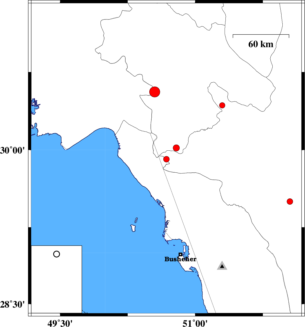
| 2014/12/21 | 09:42:44.1 | 13:12:44.1 | 29.91 | 50.68 | 14 | ML:3 | Fars Province, 40 km North-East of Bandar-e genaveh | ||
| 2014/12/12 | 20:45:42.3 | 00:15:42.3 | 30.56 | 50.55 | 14 | ML:5.2 | Kohkiluieh va boyerahmad Province, 26 km South of Dehdasht | ||
| 2014/12/10 | 17:01:06.4 | 20:31:06.4 | 30.43 | 51.3 | 14 | ML:2.8 | Fars Province, 38 km South-West of Yasuj | ||
| 2014/12/07 | 14:37:35.5 | 18:07:35.5 | 30.02 | 50.79 | 14 | ML:3.2 | Kohkiluieh va boyerahmad Province, 38 km South of Dogonbadan | ||
| 2014/12/03 | 09:41:26.2 | 13:11:26.2 | 29.5 | 52.05 | 15 | ML:2.9 | Fars Province, 40 km South-East of Kazerun |

 IIEES All Rights Reserved