
Magnitude |
2.5 |
| Date & Time (UTC) | 2015-05-06 19:57:21.0 |
| Date & Time (Local) | 1394/2/17 00:27:21.0 |
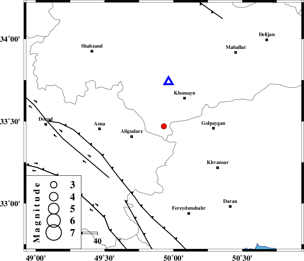
| Location | Lat:33.47 Lon: 49.93 |
| Region | Markazi Province, 23 km East of Aligudarz |
Nearest Cities |
|
| 3 km North of Dehnu, Markazi Province | |
| 6 km of Farnaq, Markazi Province | |
| 19 km North of Halaghareh, Lorestan Province | |
| 21 km North East of Khameh sofla, Lorestan Province | |
| 22 km South East of Javadiyeh, Markazi Province | |
| Depth | 6 km |
| Agency | |
Faults within 150 km: |
|
| MAIN_ZAGROS_R_F (Length: 1106 km) , Distance to epicenter: 46 km | |
| DORUD (Length: 100 km) , Distance to epicenter: 51 km | |
| ARDAL_F (Length: 170 km) , Distance to epicenter: 57 km | |
| Number of Phases | 4 |
| RMS | 0 |
| Number of Stations | 3 |
| Error in Latitude | >6 km |
| Error in Longitude | 3.1 km |
| Error in Depth | 6.3 km |
Download waveform in seisan format
to download seisan software Click here
to access information about IIEES stations Click here
Amplitude | ||||||||
| UID | Agency | Station | Component | Amplitude | Period | Arrival Time | Proccessing Time | Signal Clip |
| 95596 | IIEES | GHVR | N | 65.9 | 0.24 | 2015-05-06 19:58:12 | 2015-05-06 09:38:00 | n |
Phase | ||||||||||||
| Agency | Station | Component | Phase Type | Phase Quality | First Motion | Observed Arrival Time | Time Residual | Loc. Flag | Input Weight | Distance | Azimuth | |
| IIEES | KHMZ | Z | Pg | E | 2015-05-06 19:57:26 | -0.03 | y | 30.3 | 6 | |||
| IIEES | GHVR | Z | Pg | E | 2015-05-06 19:57:49 | -0.03 | y | 166 | 47 | |||
| IIEES | GHVR | N | Sg | E | 2015-05-06 19:58:10 | 0.03 | y | 166 | 47 | |||
| IIEES | SNGE | Z | Pn | E | 2015-05-06 19:58:06 | 0.03 | y | 298 | 308 | |||