Home / Recent Earthquakes

| Prel. Rep. | Date | Time(UTC) | Time(Local) | Lat. | Lon. | Depth | Mag. | Region | Waveform |
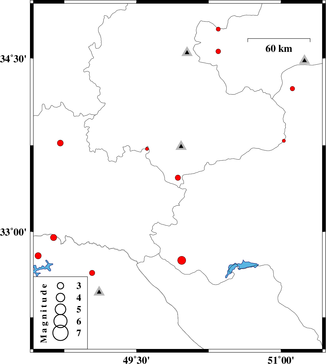
| 2015/05/06 | 19:57:21.0 | 00:27:21.0 | 33.47 | 49.93 | 6 | ML:2.5 | Markazi Province, 23 km East of Aligudarz | ||
| 2015/05/06 | 05:38:44.3 | 10:08:44.3 | 34.56 | 50.35 | 15 | ML:2.2 | Qom Province, 32 km East of Ashtiyan | ||
| 2015/05/05 | 23:35:11.5 | 04:05:11.5 | 32.75 | 49.97 | 18 | ML:3.8 | Esfahan Province, 25 km South-West of Fereydunshahr | ||
| 2015/05/05 | 08:27:18.5 | 12:57:18.5 | 33.79 | 51.03 | 14 | ML:1.6 | Esfahan Province, 39 km South-East of Delijan | ||
| 2015/05/05 | 05:09:41.5 | 09:39:41.5 | 33.72 | 49.61 | 14 | ML:1.6 | Lorestan Province, 36 km North of Aligudarz | ||
| 2015/05/03 | 17:22:30.5 | 21:52:30.5 | 32.47 | 48.68 | 14 | ML:2.7 | Khoozestan Province, 30 km East of Andimeshk | ||
| 2015/05/01 | 00:40:33.6 | 05:10:33.6 | 32.21 | 48.63 | 14 | ML:2.5 | Khoozestan Province, 35 km East of Shush | ||
| 2015/04/30 | 09:43:18.4 | 14:13:18.4 | 34.75 | 50.35 | 23 | ML:2 | Qom Province, 30 km South of Saveh | ||
| 2015/04/30 | 00:13:02.1 | 04:43:02.1 | 32.47 | 48.73 | 14 | ML:3.3 | Khoozestan Province, 35 km East of Andimeshk | ||
| 2015/04/28 | 01:36:38.5 | 06:06:38.5 | 34.24 | 51.12 | 29 | ML:2.1 | Esfahan Province, 37 km North-West of Aran va bidgol | ||
| 2015/04/23 | 14:46:25.9 | 19:16:25.9 | 33.77 | 48.71 | 15 | ML:2.8 | Lorestan Province, 14 km South of Borujerd | ||
| 2015/04/21 | 03:27:01.7 | 07:57:01.7 | 32.95 | 48.64 | 14 | ML:2.9 | Khoozestan Province, 61 km North-East of Andimeshk | ||
| 2015/04/16 | 21:03:49.4 | 01:33:49.4 | 32.64 | 49.04 | 15 | ML:2.6 | Khoozestan Province, 29 km North of Lali | ||
| 2015/04/10 | 17:27:52.0 | 21:57:52.0 | 32.79 | 48.48 | 17 | ML:2.9 | Khoozestan Province, 38 km North-East of Andimeshk | ||
| 2015/04/07 | 13:11:00.1 | 17:41:00.1 | 32.36 | 48.65 | 14 | ML:2.8 | Khoozestan Province, 24 km East of Dezful | ||
| 2015/04/07 | 12:13:34.0 | 16:43:34.0 | 32.37 | 48.69 | 14 | ML:3.6 | Khoozestan Province, 27 km East of Dezful |