Home / Recent Earthquakes

| Prel. Rep. | Date | Time(UTC) | Time(Local) | Lat. | Lon. | Depth | Mag. | Region | Waveform |
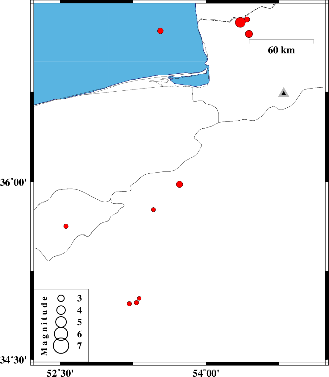
| 2015/09/17 | 23:57:30.2 | 04:27:30.2 | 35.979 | 53.727 | 14 | ML:3 | Semnan Province, 54 km North-East of Semnan | ||
| 2015/09/17 | 12:48:26.7 | 17:18:26.7 | 35.02 | 53.313 | 16 | ML:1.9 | Semnan Province, 61 km South of Semnan | ||
| 2015/09/16 | 22:13:58.0 | 02:43:58.0 | 34.975 | 53.212 | 14 | ML:2.1 | Semnan Province, 68 km South-West of Semnan | ||
| 2015/09/16 | 07:47:47.4 | 12:17:47.4 | 35.628 | 52.558 | 18 | ML:2.1 | Tehran Province, 23 km South-West of Firuzkuh | ||
| 2015/09/15 | 17:35:49.8 | 22:05:49.8 | 37.322 | 54.352 | 17 | ML:4.7 | Golestan Province, 36 km North-West of Aq Qaleh | download | |
| 2015/09/14 | 14:58:41.2 | 19:28:41.2 | 37.347 | 54.421 | 18 | ML:2.6 | Golestan Province, 37 km North of Aq Qaleh | ||
| 2015/09/14 | 13:30:42.2 | 18:00:42.2 | 35.767 | 53.459 | 18 | ML:2 | Semnan Province, 23 km North of Semnan | ||
| 2015/09/13 | 22:53:58.9 | 03:23:58.9 | 37.253 | 53.531 | 14 | ML:2.7 | Caspian Sea, 62 km North of Behshahr | ||
| 2015/09/11 | 08:13:02.6 | 12:43:02.6 | 37.227 | 54.441 | 15 | ML:3.4 | Golestan Province, 24 km North of Aq Qaleh | ||
| 2015/09/11 | 05:08:40.4 | 09:38:40.4 | 34.983 | 53.285 | 17 | ML:2.1 | Semnan Province, 66 km South-West of Semnan |