Home / Recent Earthquakes

| Prel. Rep. | Date | Time(UTC) | Time(Local) | Lat. | Lon. | Depth | Mag. | Region | Waveform |
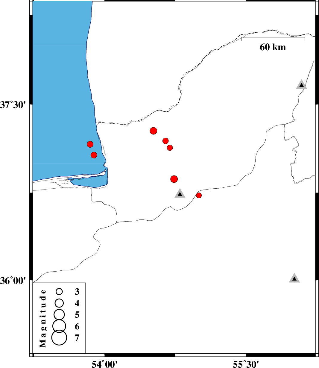
| 2016/02/18 | 17:52:00.8 | 21:22:00.8 | 36.866 | 54.737 | 15 | ML:3.4 | Golestan Province, 12 km -West of Ali Abad | ||
| 2016/02/15 | 03:04:57.6 | 06:34:57.6 | 36.727 | 55.001 | 14 | ML:2.5 | Semnan Province, 23 km South-East of Ali Abad | ||
| 2016/02/13 | 01:07:06.4 | 04:37:06.4 | 37.276 | 54.518 | 18 | ML:3.4 | Golestan Province, 30 km North of Aq Qaleh | ||
| 2016/02/06 | 14:02:08.3 | 17:32:08.3 | 37.191 | 54.647 | 15 | ML:2.8 | Golestan Province, 26 km North-East of Aq Qaleh | ||
| 2016/01/28 | 09:04:46.1 | 12:34:46.1 | 37.132 | 54.693 | 16 | ML:2.7 | Golestan Province, 25 km North-East of Aq Qaleh | ||
| 2016/01/25 | 10:43:36.3 | 14:13:36.3 | 37.07 | 53.887 | 14 | ML:3 | Caspian Sea, 25 km North-West of Bandar-e torkaman | ||
| 2016/01/20 | 07:40:51.6 | 11:10:51.6 | 37.162 | 53.846 | 15 | ML:3 | Caspian Sea, 35 km North-West of Bandar-e torkaman |