Home / Recent Earthquakes

| Prel. Rep. | Date | Time(UTC) | Time(Local) | Lat. | Lon. | Depth | Mag. | Region | Waveform |
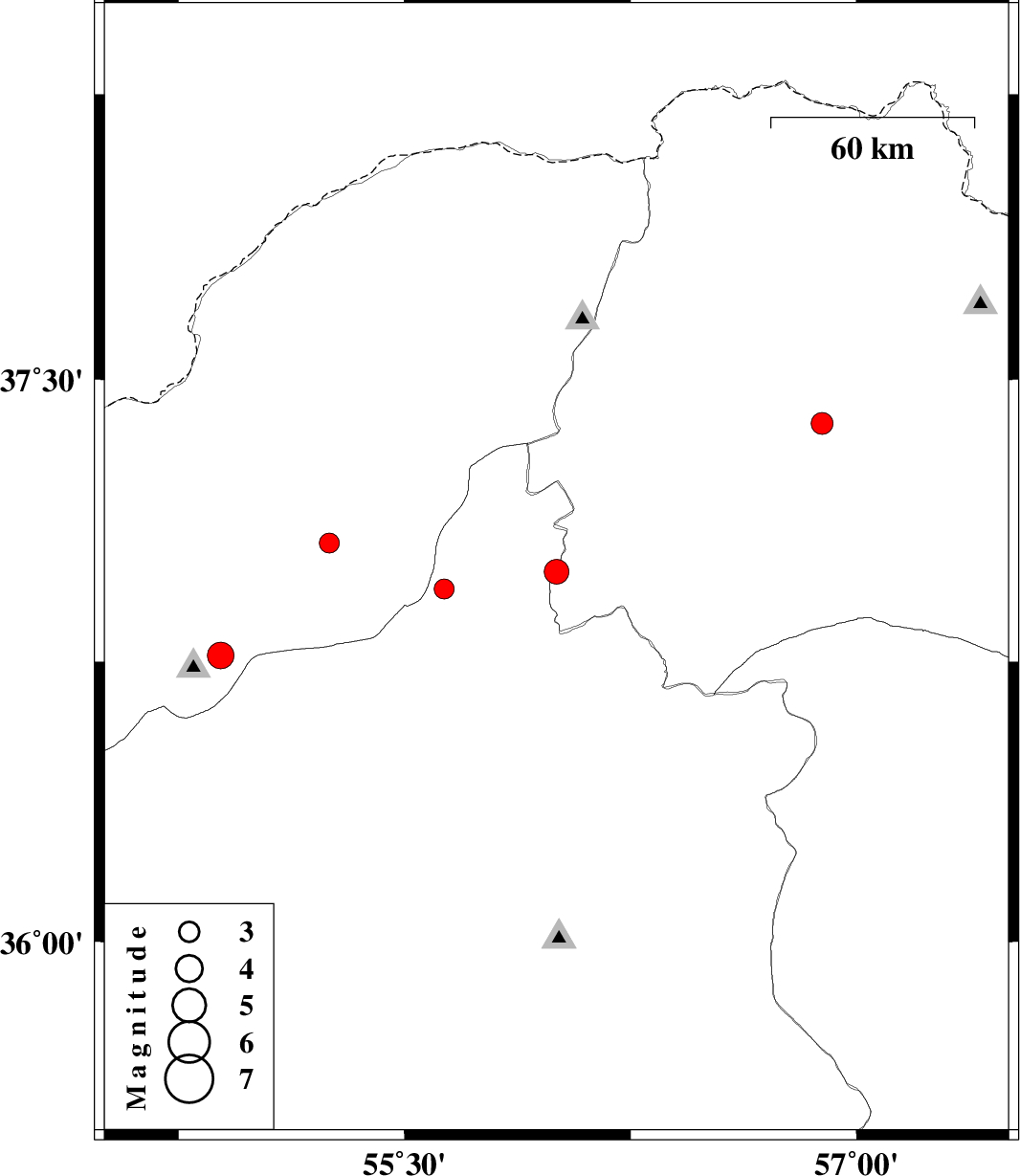
| 2016/12/15 | 22:01:30.6 | 01:31:30.6 | 36.991 | 56.004 | 9 | ML:3.7 | Khorasan(north) Province, 34 km -West of Jajarm | ||
| 2016/12/02 | 22:29:51.0 | 01:59:51.0 | 36.767 | 54.889 | 15 | ML:4 | Golestan Province, 15 km South of Ali Abad | ||
| 2016/11/20 | 18:07:11.6 | 21:37:11.6 | 36.945 | 55.631 | 28 | ML:2.9 | Semnan Province, 38 km South-East of Minodasht | ||
| 2016/11/16 | 16:12:25.7 | 19:42:25.7 | 37.384 | 56.885 | 15 | ML:3.3 | Khorasan(north) Province, 19 km South of Ashkhaneh | ||
| 2016/11/15 | 18:48:15.2 | 22:18:15.2 | 37.067 | 55.25 | 14 | ML:3 | Golestan Province, 7 km of Azadshahr |