Home / Recent Earthquakes

| Prel. Rep. | Date | Time(UTC) | Time(Local) | Lat. | Lon. | Depth | Mag. | Region | Waveform |
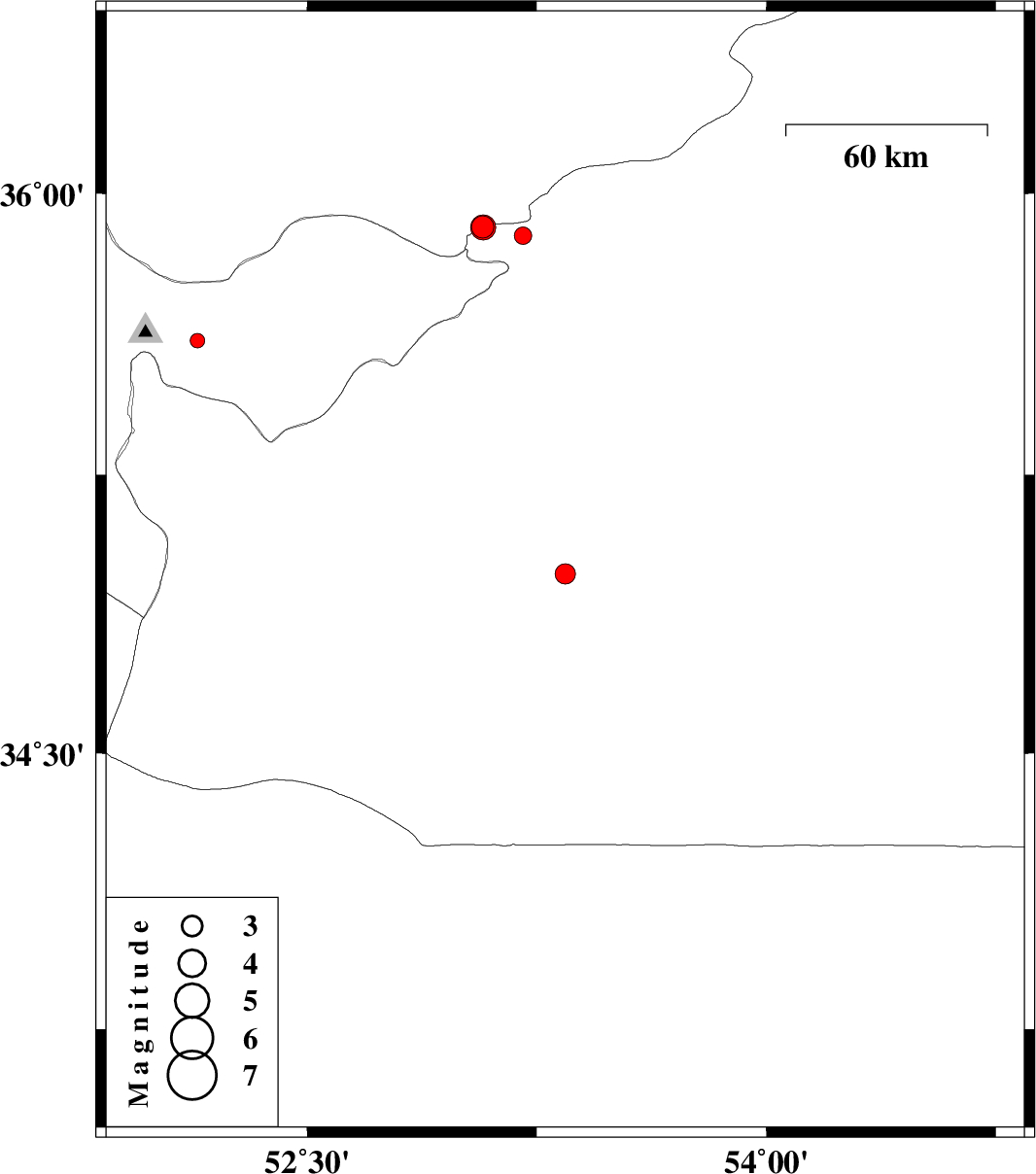
| 2017/03/07 | 08:34:57.1 | 12:04:57.1 | 34.983 | 53.343 | 14 | ML:2.9 | Semnan Province, 65 km South of Semnan | ||
| 2017/02/21 | 01:56:34.8 | 05:26:34.8 | 35.888 | 53.205 | 15 | ML:2.6 | Semnan Province, 28 km South-East of Pol-E-Sefid | ||
| 2017/02/09 | 17:04:06.0 | 20:34:06.0 | 35.608 | 52.142 | 14 | ML:2.1 | Tehran Province, 13 km South of Damavand | ||
| 2017/02/08 | 05:35:39.7 | 09:05:39.7 | 35.911 | 53.073 | 15 | ML:3.2 | Semnan Province, 23 km South of Pol-E-Sefid | ||
| 2017/02/08 | 05:31:49.5 | 09:01:49.5 | 35.909 | 53.075 | 15 | ML:3.7 | Semnan Province, 23 km South of Pol-E-Sefid |