Home / Recent Earthquakes

| Prel. Rep. | Date | Time(UTC) | Time(Local) | Lat. | Lon. | Depth | Mag. | Region | Waveform |
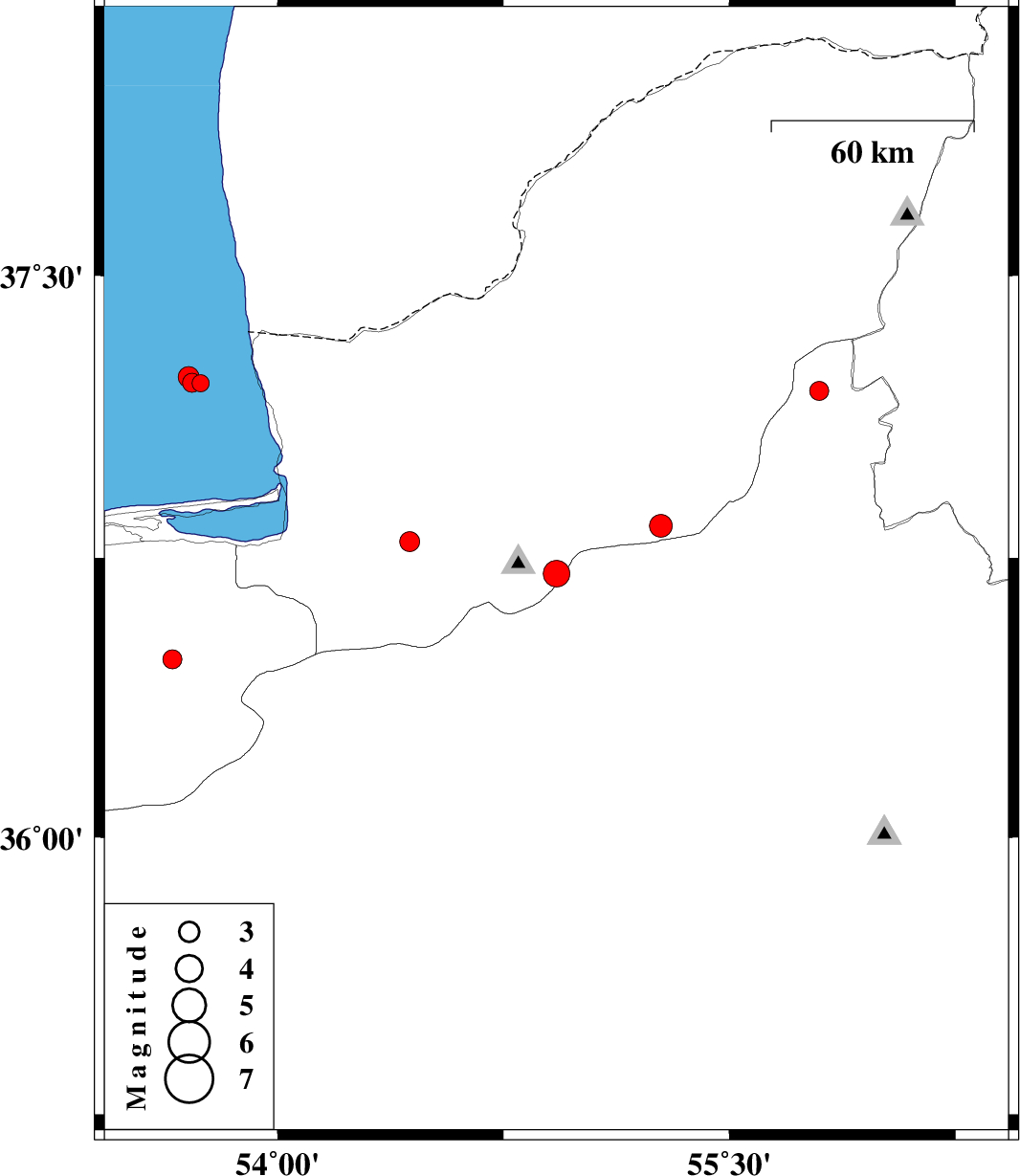
| 2017/03/12 | 19:08:10.5 | 22:38:10.5 | 36.708 | 54.926 | 17 | ML:4 | Golestan Province, 23 km South of Ali Abad | ||
| 2017/03/10 | 01:33:39.6 | 05:03:39.6 | 37.195 | 55.797 | 8 | ML:2.8 | Semnan Province, 36 km -East of Minodasht | ||
| 2017/03/08 | 15:22:59.1 | 18:52:59.1 | 36.479 | 53.652 | 14 | ML:2.8 | Mazandaran Province, 26 km South-East of Behshahr | ||
| 2017/03/01 | 10:19:44.1 | 13:49:44.1 | 36.793 | 54.439 | 15 | ML:3 | Golestan Province, 5 km of Gorgan | ||
| 2017/02/21 | 09:51:40.7 | 13:21:40.7 | 37.215 | 53.745 | 14 | ML:2.5 | Caspian Sea, 46 km North-West of Bandar-e torkaman | ||
| 2017/02/21 | 04:27:21.0 | 07:57:21.0 | 37.216 | 53.717 | 15 | ML:2.8 | Caspian Sea, 47 km North-West of Bandar-e torkaman | ||
| 2017/02/21 | 04:14:04.3 | 07:44:04.3 | 37.231 | 53.705 | 15 | ML:3.1 | Caspian Sea, 49 km North-West of Bandar-e torkaman | ||
| 2017/02/13 | 02:27:10.1 | 05:57:10.1 | 36.835 | 55.273 | 9 | ML:3.4 | Golestan Province, 23 km South-East of Ramian |