Home / Recent Earthquakes

| Prel. Rep. | Date | Time(UTC) | Time(Local) | Lat. | Lon. | Depth | Mag. | Region | Waveform |
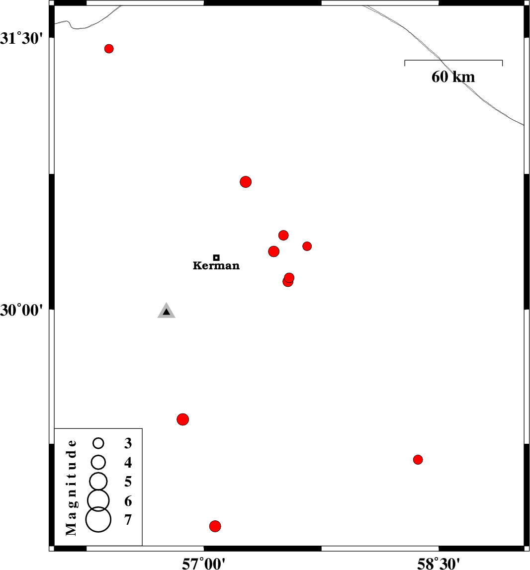
| 2017/08/25 | 10:12:51.9 | 14:42:51.9 | 30.176 | 57.544 | 14 | ML:2.8 | Kerman Province, 46 km South-East of Kerman | ||
| 2017/08/22 | 13:46:44.4 | 18:16:44.4 | 31.439 | 56.393 | 14 | ML:2.5 | Kerman Province, 44 km North-West of Ravar | ||
| 2017/08/20 | 01:05:00.5 | 05:35:00.5 | 30.321 | 57.445 | 14 | ML:3.1 | Kerman Province, 35 km -East of Kerman | ||
| 2017/08/14 | 00:13:00.7 | 04:43:00.7 | 29.386 | 56.864 | 15 | ML:3.4 | Kerman Province, 30 km North-East of Baft | ||
| 2017/08/12 | 10:29:35.1 | 14:59:35.1 | 30.707 | 57.266 | 14 | ML:3.2 | Kerman Province, 50 km North-East of Kerman | ||
| 2017/08/08 | 03:52:31.8 | 08:22:31.8 | 30.35 | 57.658 | 14 | ML:2.5 | Kerman Province, 56 km -East of Kerman | ||
| 2017/07/30 | 07:49:33.9 | 12:19:33.9 | 30.155 | 57.537 | 14 | ML:2.9 | Kerman Province, 46 km South-East of Kerman | ||
| 2017/07/27 | 19:07:12.6 | 23:37:12.6 | 28.787 | 57.071 | 15 | ML:3.3 | Kerman Province, 66 km North-West of Jiroft | ||
| 2017/07/27 | 04:37:47.4 | 09:07:47.4 | 29.16 | 58.367 | 14 | ML:2.7 | Kerman Province, 6 km of Bam | ||
| 2017/07/26 | 06:09:19.0 | 10:39:19.0 | 30.411 | 57.507 | 14 | ML:2.8 | Kerman Province, 43 km North-East of Kerman |