Home / Recent Earthquakes

| Prel. Rep. | Date | Time(UTC) | Time(Local) | Lat. | Lon. | Depth | Mag. | Region | Waveform |
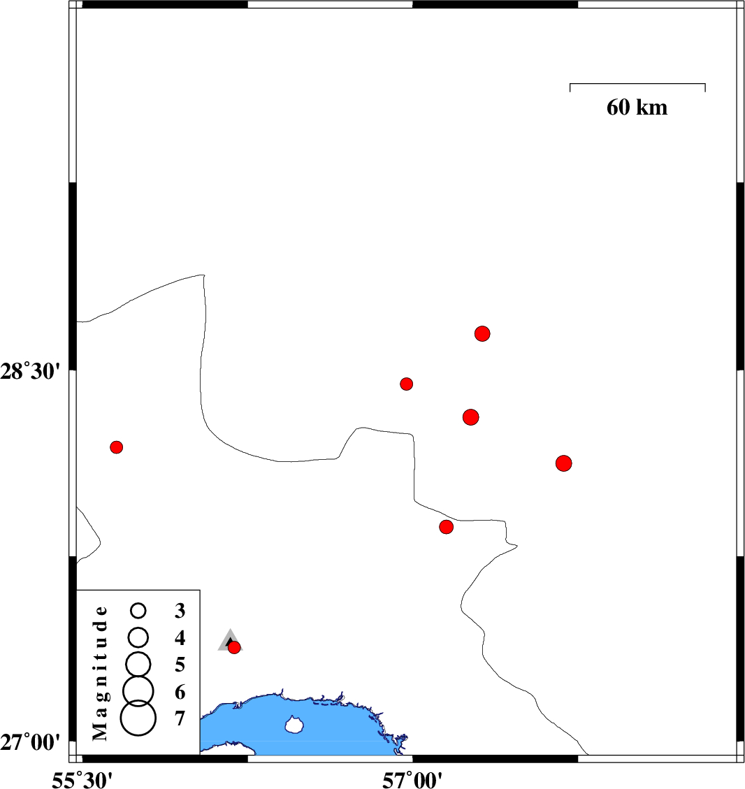
| 2017/10/21 | 09:32:48.7 | 13:02:48.7 | 28.19 | 55.653 | 18 | ML:2.5 | Hormozgan Province, 28 km South-West of Hajiabad | ||
| 2017/10/21 | 01:26:35.8 | 04:56:35.8 | 28.443 | 56.971 | 18 | ML:2.6 | Kerman Province, 79 km South-West of Jiroft | ||
| 2017/10/20 | 08:24:52.1 | 11:54:52.1 | 28.124 | 57.686 | 18 | ML:3.2 | Kerman Province, 19 km North of Kahnuj | ||
| 2017/10/19 | 07:19:42.0 | 10:49:42.0 | 27.868 | 57.152 | 14 | ML:2.8 | Hormozgan Province, 50 km North of Dehbarez | ||
| 2017/10/17 | 21:38:30.9 | 01:08:30.9 | 28.31 | 57.264 | 16 | ML:3.3 | Kerman Province, 58 km North-West of Kahnuj | ||
| 2017/10/17 | 00:42:04.3 | 04:12:04.3 | 28.646 | 57.316 | 15 | ML:3.1 | Kerman Province, 41 km -West of Jiroft | ||
| 2017/10/14 | 08:17:13.4 | 11:47:13.4 | 27.38 | 56.188 | 10 | ML:2.6 | Hormozgan Province, 24 km North of Bandar-e abbas |