Home / Recent Earthquakes

| Prel. Rep. | Date | Time(UTC) | Time(Local) | Lat. | Lon. | Depth | Mag. | Region | Waveform |
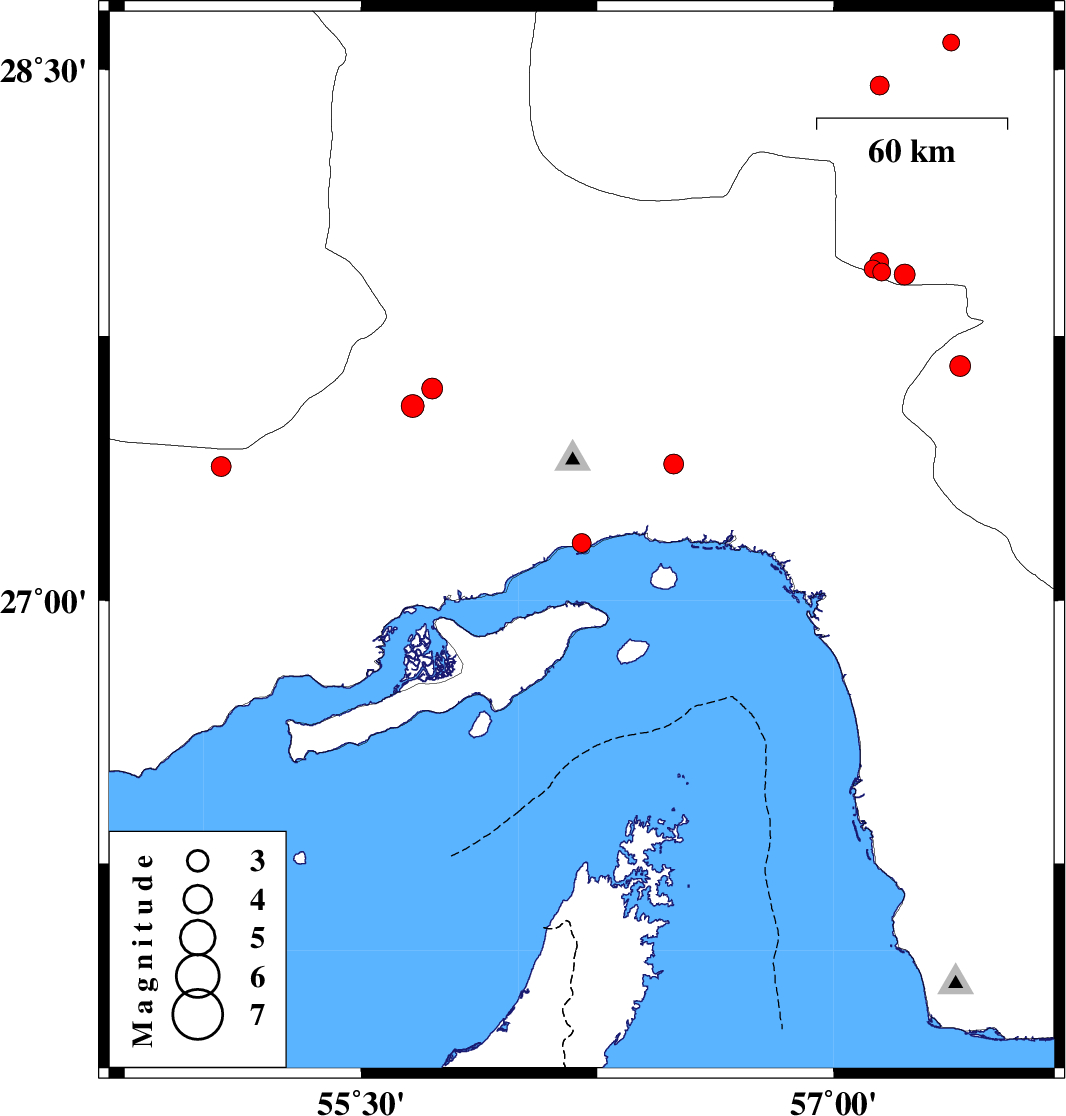
| 2017/10/31 | 14:19:17.5 | 17:49:17.5 | 27.164 | 56.2 | 14 | ML:2.7 | Hormozgan Province, 8 km of Bandar-e abbas | ||
| 2017/10/29 | 22:36:56.5 | 02:06:56.5 | 27.923 | 57.225 | 14 | ML:2.9 | Kerman Province, 46 km -West of Kahnuj | ||
| 2017/10/29 | 17:38:42.7 | 21:08:42.7 | 27.601 | 55.725 | 16 | ML:3 | Hormozgan Province, 81 km South-West of Hajiabad | ||
| 2017/10/29 | 16:59:59.6 | 20:29:59.6 | 27.552 | 55.664 | 18 | ML:3.2 | Hormozgan Province, 73 km North-West of Bandar-e abbas | ||
| 2017/10/28 | 10:04:28.1 | 13:34:28.1 | 27.381 | 55.055 | 14 | ML:2.8 | Hormozgan Province, 71 km North-East of Bastak | ||
| 2017/10/28 | 02:31:02.4 | 06:01:02.4 | 28.455 | 57.147 | 6 | ML:2.7 | Kerman Province, 63 km South-West of Jiroft | ||
| 2017/10/27 | 21:56:02.4 | 01:26:02.4 | 27.931 | 57.152 | 14 | ML:2.5 | Kerman Province, 53 km -West of Kahnuj | ||
| 2017/10/26 | 09:15:13.3 | 12:45:13.3 | 27.939 | 57.126 | 14 | ML:2.6 | Kerman Province, 56 km -West of Kahnuj | ||
| 2017/10/26 | 00:57:10.7 | 04:27:10.7 | 27.665 | 57.402 | 17 | ML:2.9 | Kerman Province, 30 km North of Manujan | ||
| 2017/10/25 | 14:38:32.8 | 18:08:32.8 | 27.959 | 57.145 | 14 | ML:2.7 | Kerman Province, 54 km -West of Kahnuj | ||
| 2017/10/25 | 07:57:08.4 | 11:27:08.4 | 27.388 | 56.492 | 14 | ML:2.8 | Hormozgan Province, 31 km North-East of Bandar-e abbas | ||
| 2017/10/24 | 19:08:34.2 | 22:38:34.2 | 28.575 | 57.373 | 18 | ML:2.4 | Kerman Province, 37 km -West of Jiroft |