Home / Recent Earthquakes

| Prel. Rep. | Date | Time(UTC) | Time(Local) | Lat. | Lon. | Depth | Mag. | Region | Waveform |
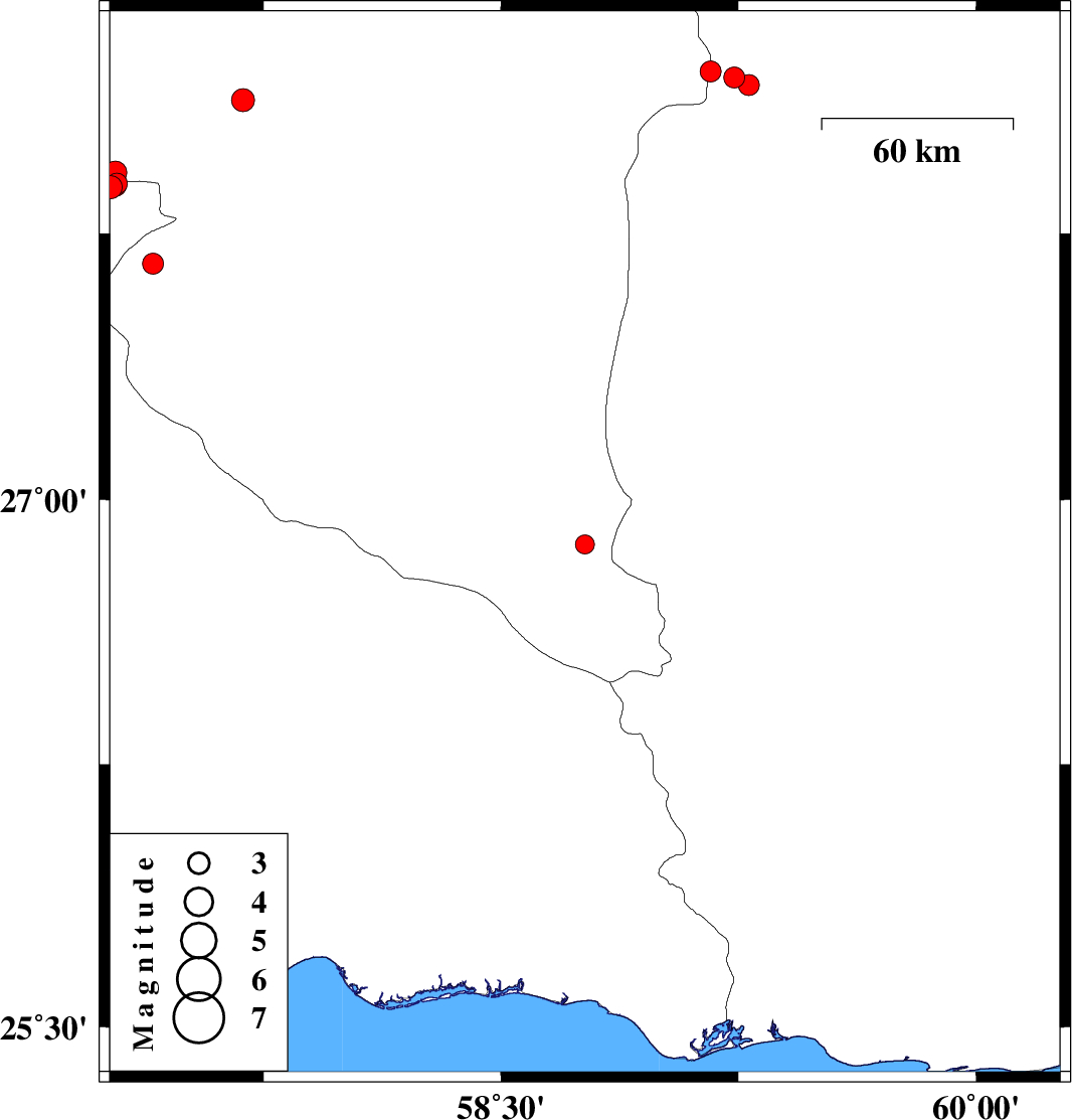
| 2017/11/09 | 07:46:41.5 | 11:16:41.5 | 26.873 | 58.765 | 14 | ML:2.7 | Kerman Province, 139 km South-East of Manujan | ||
| 2017/10/27 | 07:10:18.4 | 10:40:18.4 | 28.186 | 59.237 | 15 | ML:2.9 | Sistan va Baloochestan Province, 154 km North-East of Kahnuj | ||
| 2017/10/26 | 01:33:45.7 | 05:03:45.7 | 28.204 | 59.162 | 14 | ML:3 | Sistan va Baloochestan Province, 128 km South-East of Bam | ||
| 2017/10/26 | 00:57:10.7 | 04:27:10.7 | 27.665 | 57.402 | 17 | ML:2.9 | Kerman Province, 30 km North of Manujan | ||
| 2017/10/23 | 14:48:51.3 | 18:18:51.3 | 27.879 | 57.268 | 16 | ML:3.2 | Hormozgan Province, 50 km North of Dehbarez | ||
| 2017/10/23 | 06:31:39.8 | 10:01:39.8 | 27.89 | 57.287 | 14 | ML:3 | Hormozgan Province, 41 km -West of Kahnuj | ||
| 2017/10/23 | 02:19:57.3 | 05:49:57.3 | 27.92 | 57.282 | 17 | ML:3.3 | Kerman Province, 41 km -West of Kahnuj | ||
| 2017/10/23 | 01:56:14.1 | 05:26:14.1 | 27.898 | 57.266 | 14 | ML:3.3 | Kerman Province, 42 km -West of Kahnuj | ||
| 2017/10/23 | 00:42:01.2 | 04:12:01.2 | 27.884 | 57.284 | 14 | ML:2.9 | Hormozgan Province, 41 km -West of Kahnuj | ||
| 2017/10/20 | 08:24:52.1 | 11:54:52.1 | 28.124 | 57.686 | 18 | ML:3.2 | Kerman Province, 19 km North of Kahnuj | ||
| 2017/10/16 | 10:29:24.1 | 13:59:24.1 | 28.165 | 59.283 | 15 | ML:3 | Sistan va Baloochestan Province, 158 km North-East of Kahnuj |