Home / Recent Earthquakes

| Prel. Rep. | Date | Time(UTC) | Time(Local) | Lat. | Lon. | Depth | Mag. | Region | Waveform |
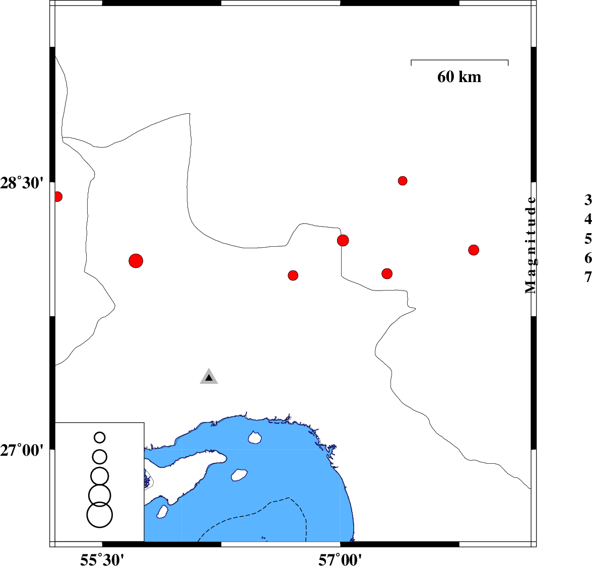
| 2017/12/16 | 16:48:36.2 | 20:18:36.2 | 27.978 | 56.702 | 15 | ML:2.8 | Hormozgan Province, 97 km -West of Kahnuj | ||
| 2017/12/08 | 13:07:16.0 | 16:37:16.0 | 28.507 | 57.393 | 14 | ML:2.5 | Kerman Province, 38 km South-West of Jiroft | ||
| 2017/12/04 | 18:46:17.8 | 22:16:17.8 | 28.12 | 57.84 | 14 | ML:2.9 | Kerman Province, 24 km North-East of Kahnuj | ||
| 2017/11/27 | 23:01:53.4 | 02:31:53.4 | 28.418 | 55.217 | 14 | ML:2.8 | Fars Province, 68 km North-West of Hajiabad | ||
| 2017/11/27 | 08:43:55.3 | 12:13:55.3 | 27.988 | 57.294 | 17 | ML:3 | Kerman Province, 40 km -West of Kahnuj | ||
| 2017/11/23 | 02:47:23.8 | 06:17:23.8 | 28.06 | 55.712 | 16 | ML:3.9 | Hormozgan Province, 33 km South-West of Hajiabad | ||
| 2017/11/20 | 06:37:24.0 | 10:07:24.0 | 28.173 | 57.016 | 15 | ML:3.3 | Kerman Province, 71 km North-West of Kahnuj |