Home / Recent Earthquakes

| Prel. Rep. | Date | Time(UTC) | Time(Local) | Lat. | Lon. | Depth | Mag. | Region | Waveform |
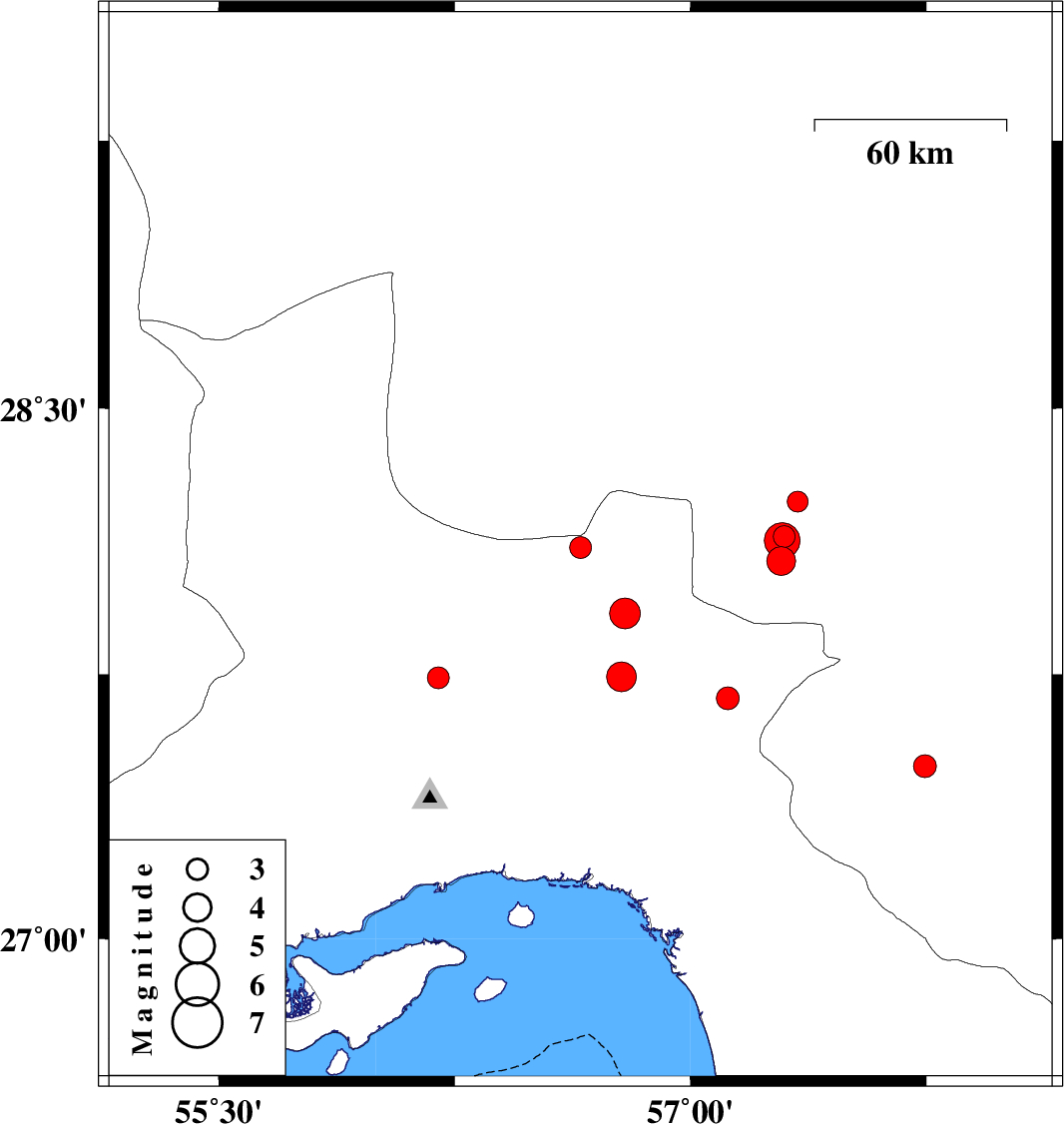
| 2025/06/24 | 16:03:40.6 | 19:33:40.6 | 28.109 | 56.65 | 17 | ML:3.1 | Hormozgan Province, 77 km South-East of Hajiabad | ||
| 2025/06/22 | 04:53:36.0 | 08:23:36.0 | 27.923 | 56.791 | 12 | ML:4.4 | Hormozgan Province, 89 km -West of Kahnuj | ||
| 2025/06/19 | 08:13:07.7 | 11:43:07.7 | 27.744 | 56.78 | 12 | ML:4.2 | Hormozgan Province, 57 km North-West of Dehbarez | ||
| 2025/06/17 | 22:59:48.0 | 02:29:48.0 | 27.741 | 56.197 | 12 | ML:3.1 | Hormozgan Province, 63 km North of Bandar-e abbas | ||
| 2025/06/17 | 11:19:44.9 | 14:49:44.9 | 27.49 | 57.745 | 12 | ML:3.3 | Kerman Province, 26 km -East of Manujan | ||
| 2025/06/16 | 00:42:02.3 | 04:12:02.3 | 26.977 | 55.542 | 12 | ML:3.2 | Hormozgan Province, 72 km -West of Qeshm | ||
| 2025/06/05 | 20:42:37.5 | 00:12:37.5 | 27.683 | 57.118 | 12 | ML:3.3 | Hormozgan Province, 31 km North-West of Dehbarez | ||
| 2025/06/01 | 11:56:45.0 | 15:26:45.0 | 26.708 | 55.222 | 12 | ML:3.3 | Persian Gulf, 42 km North-East of Bandar-e lengeh | ||
| 2025/05/29 | 21:49:08.2 | 01:19:08.2 | 28.07 | 57.289 | 14 | ML:4.1 | Kerman Province, 42 km North-West of Kahnuj | ||
| 2025/05/28 | 23:45:39.5 | 03:15:39.5 | 28.14 | 57.298 | 12 | ML:3.1 | Kerman Province, 44 km North-West of Kahnuj | ||
| 2025/05/28 | 21:30:02.8 | 01:00:02.8 | 28.128 | 57.292 | 14 | ML:5.1 | Kerman Province, 44 km North-West of Kahnuj | ||
| 2025/05/26 | 15:02:41.1 | 18:32:41.1 | 28.238 | 57.34 | 10 | ML:3 | Kerman Province, 47 km North-West of Kahnuj |