Home / Recent Earthquakes

| Prel. Rep. | Date | Time(UTC) | Time(Local) | Lat. | Lon. | Depth | Mag. | Region | Waveform |
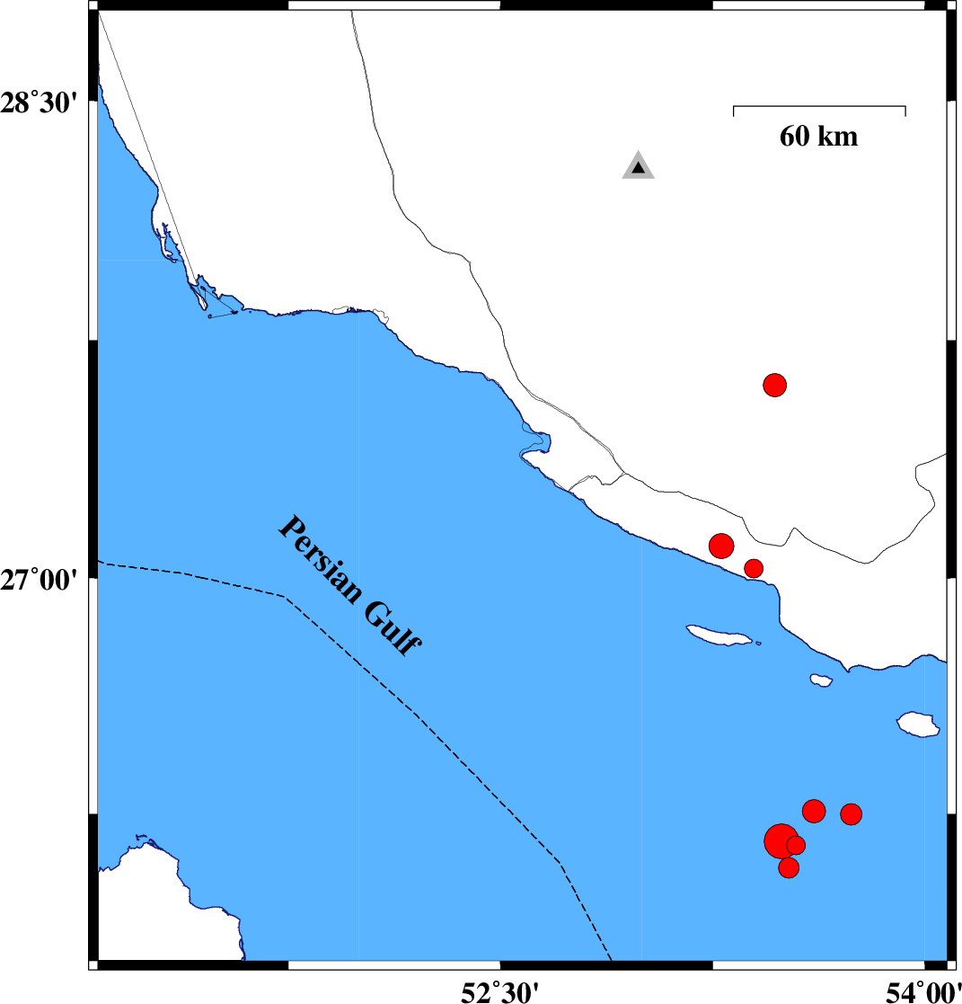
| 2026/02/01 | 16:29:31.0 | 19:59:31.0 | 27.381 | 52.772 | 12 | ML:3.4 | Bushehr Province, 22 km South-West of Mehr | ||
| 2026/02/01 | 12:02:22.5 | 15:32:22.5 | 27.283 | 52.577 | 16 | ML:3 | Persian Gulf, 42 km South-West of Mehr | ||
| 2026/02/01 | 11:56:11.4 | 15:26:11.4 | 27.213 | 52.551 | 12 | ML:3.3 | Persian Gulf, 50 km South-West of Mehr | ||
| 2026/02/01 | 05:28:03.0 | 08:58:03.0 | 27.392 | 52.641 | 12 | ML:3.6 | Bushehr Province, 30 km South-West of Mehr | ||
| 2026/02/01 | 05:11:18.2 | 08:41:18.2 | 27.296 | 52.526 | 12 | ML:5.5 | Persian Gulf, 45 km South-West of Mehr | ||
| 2026/01/23 | 11:18:05.1 | 14:48:05.1 | 27.093 | 53.156 | 12 | ML:4.9 | Hormozgan Province, 27 km South of Lamerd | ||
| 2026/01/20 | 03:46:00.9 | 07:16:00.9 | 28.224 | 52.314 | 12 | ML:3.9 | Fars Province, 43 km North of Jam | ||
| 2026/01/11 | 01:21:00.9 | 04:51:00.9 | 28.726 | 52.503 | 8 | ML:3.7 | Fars Province, 14 km South of Firuz Abad | ||
| 2026/01/03 | 17:24:44.7 | 20:54:44.7 | 28.154 | 52.427 | 12 | ML:3 | Fars Province, 37 km North-East of Jam |