Home / Recent Earthquakes

| Prel. Rep. | Date | Time(UTC) | Time(Local) | Lat. | Lon. | Depth | Mag. | Region | Waveform |
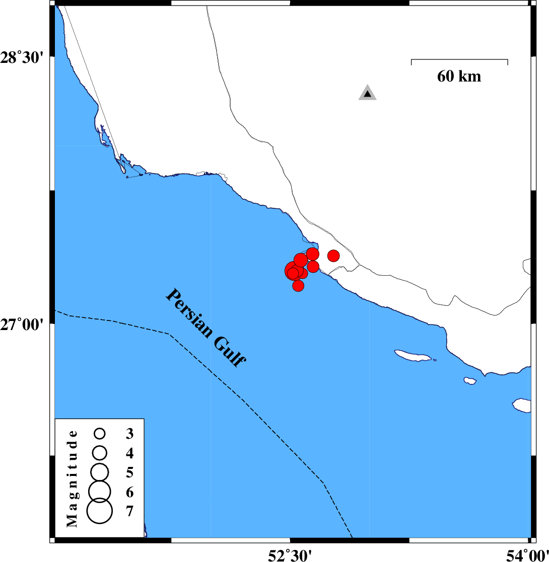
| 2026/02/03 | 05:42:13.6 | 09:12:13.6 | 27.283 | 52.517 | 12 | ML:3.3 | Persian Gulf, 47 km South-West of Mehr | ||
| 2026/02/03 | 05:20:52.2 | 08:50:52.2 | 27.32 | 52.644 | 12 | ML:3.4 | Persian Gulf, 35 km South-West of Mehr | ||
| 2026/02/02 | 21:43:36.2 | 01:13:36.2 | 27.357 | 52.567 | 12 | ML:3.9 | Persian Gulf, 38 km South-West of Mehr | ||
| 2026/02/02 | 12:19:22.0 | 15:49:22.0 | 27.298 | 52.544 | 16 | ML:3.5 | Persian Gulf, 44 km South-West of Mehr | ||
| 2026/02/01 | 16:29:31.0 | 19:59:31.0 | 27.381 | 52.772 | 12 | ML:3.4 | Bushehr Province, 22 km South-West of Mehr | ||
| 2026/02/01 | 12:02:22.5 | 15:32:22.5 | 27.283 | 52.577 | 16 | ML:3 | Persian Gulf, 42 km South-West of Mehr | ||
| 2026/02/01 | 11:56:11.4 | 15:26:11.4 | 27.213 | 52.551 | 12 | ML:3.3 | Persian Gulf, 50 km South-West of Mehr | ||
| 2026/02/01 | 05:28:03.0 | 08:58:03.0 | 27.392 | 52.641 | 12 | ML:3.6 | Bushehr Province, 30 km South-West of Mehr | ||
| 2026/02/01 | 05:11:18.2 | 08:41:18.2 | 27.296 | 52.526 | 12 | ML:5.5 | Persian Gulf, 45 km South-West of Mehr |