| Prel. Rep. | Date | Time(UTC) | Time(Local) | Lat. | Lon. | Depth | Mag. | Region | Waveform |
|
|
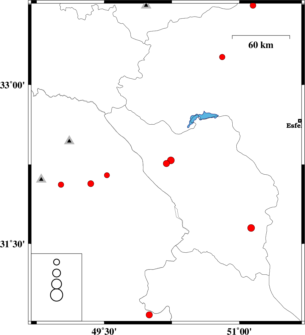
2008/05/22
|
16:32:46.3
|
21:02:46.3
| 32.26 | 50.19 | 38 |
ML:3.2
|
24 km South of Chelgard, Chaharmahal Bakhtiari Province | |
|
|
2008/05/19
|
16:52:44.5
|
21:22:44.5
| 32.29 | 50.24 | 17 |
ML:3.5
|
22 km South-East of Chelgard, Chaharmahal Bakhtiari Province | |
|
|
2008/05/19
|
05:17:18.2
|
09:47:18.2
| 32.15 | 49.53 | 14 |
ML:2.7
|
32 km North-East of Masjed Soleyman, Khoozestan Province | |
|
|
2008/05/15
|
04:28:56.8
|
08:58:56.8
| 32.07 | 49.35 | 36 |
ML:3.1
|
16 km North of Masjed Soleyman, Khoozestan Province | |
|
|
2008/05/12
|
23:54:19.6
|
04:24:19.6
| 31.65 | 51.13 | 18 |
ML:3.5
|
34 km North-East of Lordegan, Chaharmahal Bakhtiari Province | |
|
|
2008/05/07
|
09:16:58.0
|
13:46:58.0
| 33.74 | 51.15 | 26 |
ML:2.9
|
38 km South-West of Kashan, Esfahan Province | |
|
|
2008/05/04
|
01:24:12.8
|
05:54:12.8
| 32.06 | 49.02 | 25 |
ML:2.8
|
15 km East of Shushtar, Khoozestan Province | |
|
|
2008/05/02
|
22:28:22.2
|
02:58:22.2
| 30.82 | 50 | 44 |
ML:3.3
|
28 km East of Omidiyeh, Khoozestan Province | |
|
|
2008/04/24
|
02:34:50.4
|
07:04:50.4
| 33.26 | 50.81 | 14 |
ML:2.8
|
45 km East of Khvansar, Esfahan Province | |