| Prel. Rep. | Date | Time(UTC) | Time(Local) | Lat. | Lon. | Depth | Mag. | Region | Waveform |
|
|
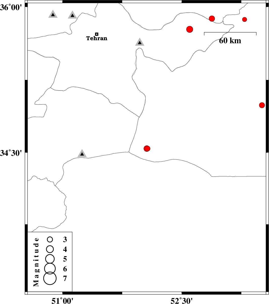
2009/07/03
|
16:10:06.2
|
20:40:06.2
| 34.54 | 52.07 | 34 |
ML:2.9
|
Semnan Province, 79 km South-West of Garmsar | |
|
|
2009/07/03
|
07:36:24.7
|
12:06:24.7
| 34.54 | 52.06 | 26 |
ML:3.4
|
Semnan Province, 80 km South-West of Garmsar | |
|
|
2009/06/28
|
06:17:06.4
|
10:47:06.4
| 34.99 | 53.51 | 46 |
ML:3.1
|
65 km South-East of Semnan, Semnan Province | |
|
|
2009/06/15
|
09:07:41.4
|
13:37:41.4
| 35.87 | 53.29 | 14 |
ML:2.6
|
34 km South-East of Pol-E-Sefid, Mazandaran Province | |
|
|
2009/06/09
|
22:55:15.1
|
03:25:15.1
| 35.77 | 52.6 | 14 |
ML:3.7
|
14 km West of Firuzkuh, Tehran Province | |
|
|
2009/06/08
|
00:05:37.2
|
04:35:37.2
| 35.88 | 52.88 | 14 |
ML:3.2
|
18 km North-East of Firuzkuh, Tehran Province | |