| Prel. Rep. | Date | Time(UTC) | Time(Local) | Lat. | Lon. | Depth | Mag. | Region | Waveform |
|
|
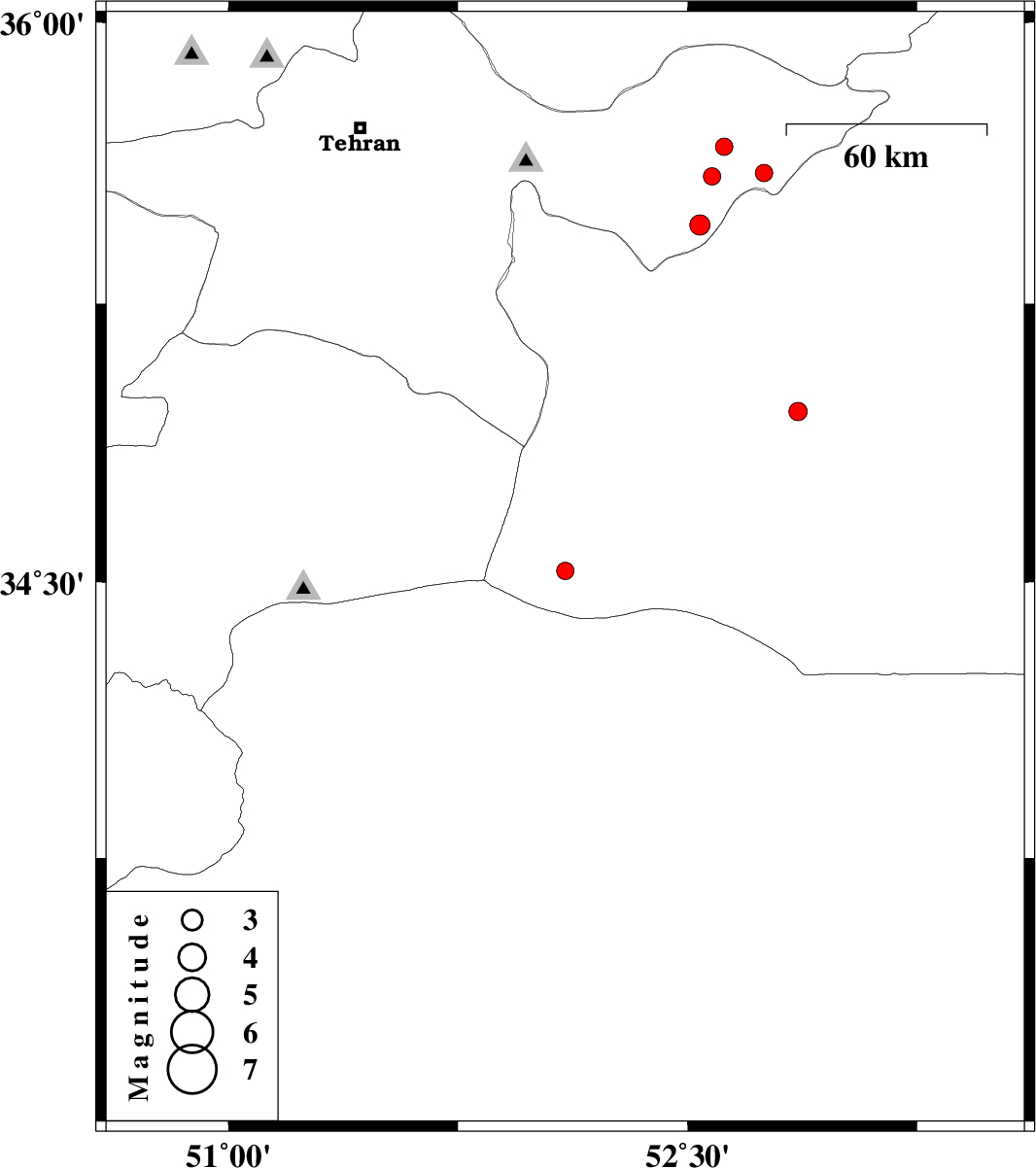
2009/08/15
|
18:21:32.1
|
22:51:32.1
| 35.67 | 52.62 | 7 |
ML:2.6
|
Tehran Province, 15 km West of Firuzkuh | |
|
|
2009/08/15
|
15:53:43.8
|
20:23:43.8
| 35.59 | 52.58 | 15 |
ML:2.6
|
Tehran Province, 24 km South-West of Firuzkuh | |
|
|
2009/08/15
|
15:51:10.9
|
20:21:10.9
| 35.46 | 52.54 | 15 |
ML:3
|
Tehran Province, 32 km North-East of Garmsar | |
|
|
2009/08/15
|
08:44:39.8
|
13:14:39.8
| 34.53 | 52.1 | 18 |
ML:2.5
|
Semnan Province, 80 km South-West of Garmsar | |
|
|
2009/08/05
|
08:02:26.6
|
12:32:26.6
| 34.96 | 52.86 | 27 |
ML:2.7
|
Semnan Province, 55 km South-East of Garmsar | |
|
|
2009/08/04
|
16:38:35.7
|
21:08:35.7
| 35.6 | 52.75 | 15 |
ML:2.5
|
Tehran Province, 16 km South of Firuzkuh | |