| Prel. Rep. | Date | Time(UTC) | Time(Local) | Lat. | Lon. | Depth | Mag. | Region | Waveform |
|
|
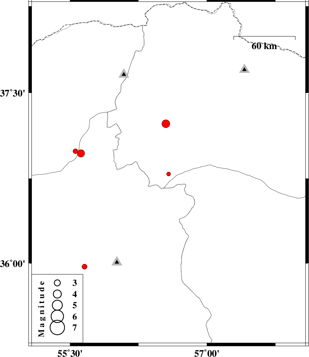
2012/10/23
|
05:16:07.8
|
08:46:07.8
| 36.79 | 56.58 | 15 |
ML:2
|
Khorasan(north) Province, 25 km South-East of Jajarm | |
|
|
2012/10/21
|
19:07:50.1
|
22:37:50.1
| 36.97 | 55.62 | 6 |
ML:3.7
|
Semnan Province, 36 km South-East of Minodasht | |
|
|
2012/10/21
|
01:27:10.3
|
04:57:10.3
| 36.99 | 55.56 | 14 |
ML:2.4
|
Golestan Province, 31 km South-East of Minodasht | |
|
|
2012/10/19
|
04:43:08.3
|
08:13:08.3
| 37.23 | 56.55 | 14 |
ML:4
|
Khorasan(north) Province, 34 km North-East of Jajarm | |
|
|
2012/10/16
|
00:15:36.2
|
03:45:36.2
| 35.97 | 55.66 | 6 |
ML:2.6
|
Semnan Province, 79 km South-East of Shahrud | |