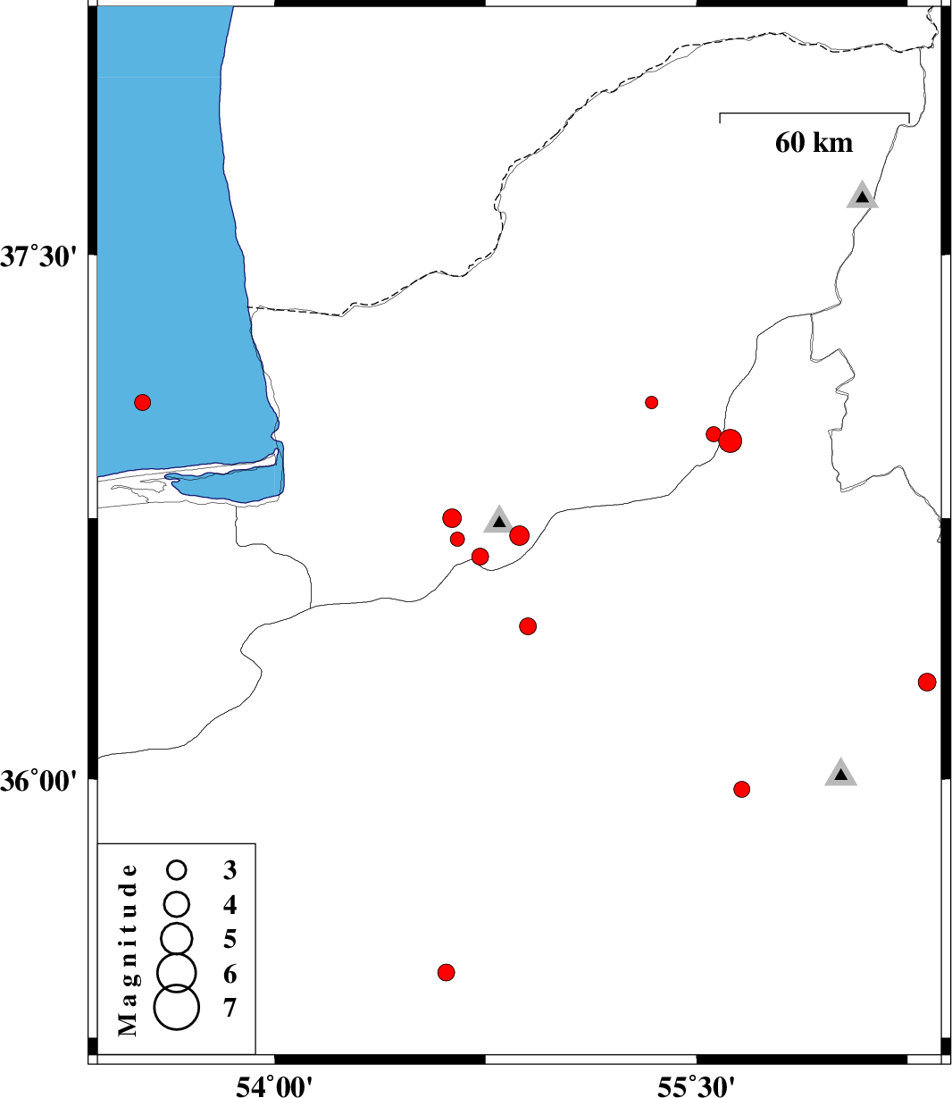
| Prel. Rep. | Date | Time(UTC) | Time(Local) | Lat. | Lon. | Depth | Mag. | Region | Waveform |
|
|
2012/11/12
|
09:11:57.7
|
12:41:57.7
| 36.7 | 54.87 | 14 |
ML:3.1
|
Golestan Province, 23 km South of Ali Abad | |
|
|
2012/11/12
|
08:35:05.9
|
12:05:05.9
| 36.75 | 54.63 | 14 |
ML:2.9
|
Golestan Province, 20 km East of Gorgan | |
|
|
2012/11/12
|
08:34:01.5
|
12:04:01.5
| 36.64 | 54.73 | 14 |
ML:2.7
|
Golestan Province, 32 km South-West of Ali Abad | |
|
|
2012/11/05
|
02:43:51.4
|
06:13:51.4
| 36.28 | 56.32 | 14 |
ML:2.8
|
Semnan Province, 75 km South of Jajarm | |
|
|
2012/11/05
|
01:12:50.2
|
04:42:50.2
| 37.08 | 53.53 | 14 |
ML:2.5
|
Caspian Sea, 43 km North of Behshahr | |
|
|
2012/10/25
|
18:19:35.0
|
21:49:35.0
| 36.69 | 54.65 | 14 |
ML:2.2
|
Golestan Province, 25 km South-East of Gorgan | |
|
|
2012/10/21
|
20:54:07.5
|
00:24:07.5
| 36.44 | 54.9 | 14 |
ML:2.7
|
Semnan Province, 6 km Shahrud | |
|
|
2012/10/21
|
19:07:50.1
|
22:37:50.1
| 36.97 | 55.62 | 6 |
ML:3.7
|
Semnan Province, 36 km South-East of Minodasht | |
|
|
2012/10/21
|
01:27:10.3
|
04:57:10.3
| 36.99 | 55.56 | 14 |
ML:2.4
|
Golestan Province, 31 km South-East of Minodasht | |
|
|
2012/10/18
|
22:31:54.5
|
02:01:54.5
| 35.44 | 54.61 | 14 |
ML:2.7
|
Semnan Province, 84 km South-East of Damghan | |
|
|
2012/10/16
|
00:15:36.2
|
03:45:36.2
| 35.97 | 55.66 | 6 |
ML:2.6
|
Semnan Province, 79 km South-East of Shahrud | |
|
|
2012/10/13
|
12:42:05.3
|
16:12:05.3
| 37.08 | 55.34 | 43 |
ML:2
|
Golestan Province, 15 km East of Azadshahr | |