Home / Recent Earthquakes

| Prel. Rep. | Date | Time(UTC) | Time(Local) | Lat. | Lon. | Depth | Mag. | Region | Waveform |
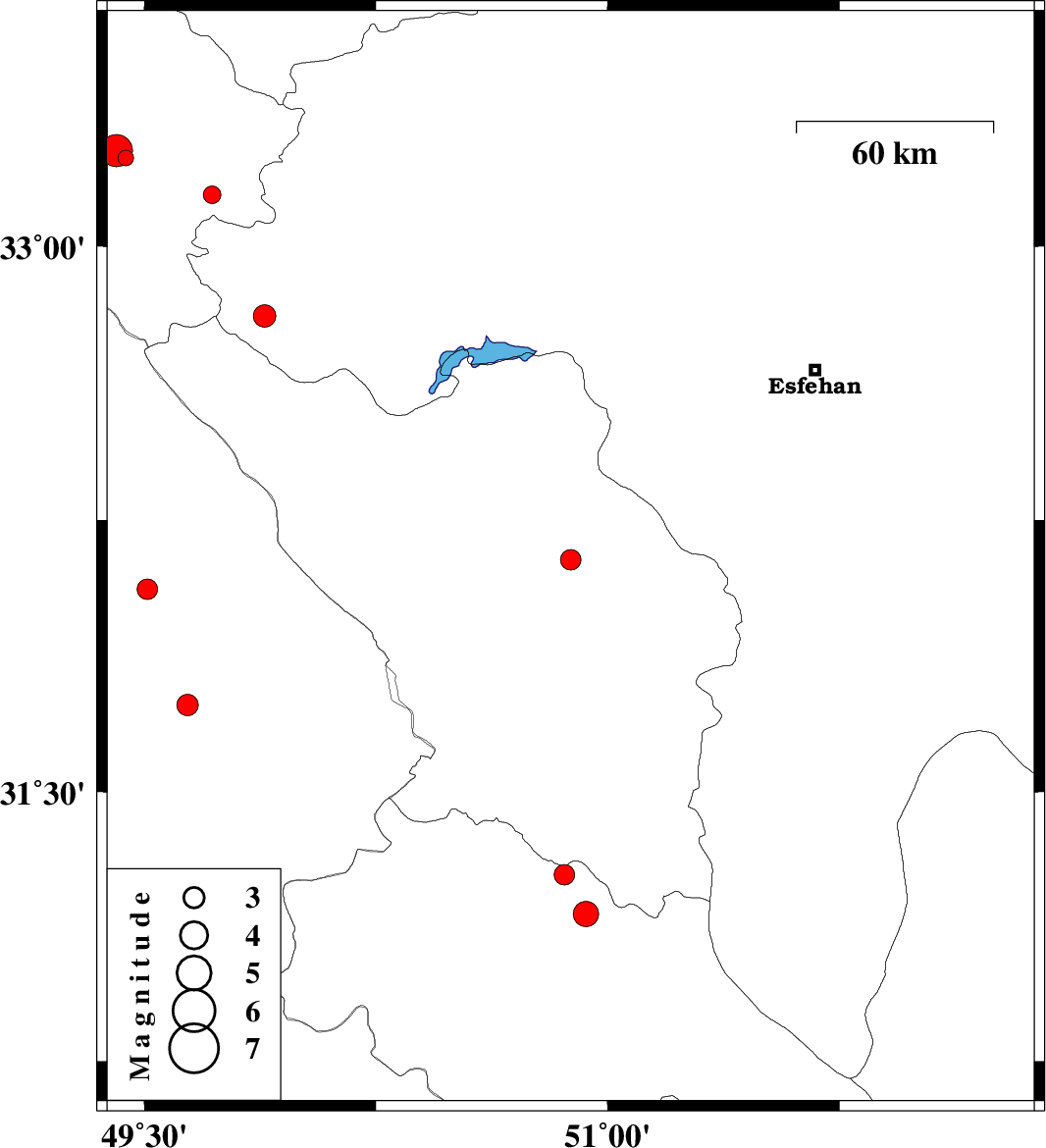
| 2012/12/08 | 16:28:08.3 | 19:58:08.3 | 32.14 | 50.88 | 16 | ML:2.9 | Chaharmahal Bakhtiari Province, 22 km South of Shahr-e kord | ||
| 2012/12/05 | 13:15:48.2 | 16:45:48.2 | 31.74 | 49.64 | 18 | ML:3.1 | Khoozestan Province, 24 km West of Izeh | ||
| 2012/12/05 | 00:42:14.8 | 04:12:14.8 | 33.24 | 49.44 | 29 | ML:2.3 | Lorestan Province, 24 km South of Azna | ||
| 2012/12/03 | 15:02:10.6 | 18:32:10.6 | 32.81 | 49.89 | 14 | ML:3.2 | Esfahan Province, 25 km South-West of Fereydunshahr | ||
| 2012/11/27 | 06:22:26.0 | 09:52:26.0 | 33.26 | 49.41 | 18 | ML:4.7 | Lorestan Province, 22 km South of Azna | ||
| 2012/11/22 | 16:26:48.4 | 19:56:48.4 | 30.93 | 49.66 | 18 | ML:3 | Khoozestan Province, 19 km North of Omidiyeh | ||
| 2012/11/19 | 22:29:14.1 | 01:59:14.1 | 31.27 | 50.86 | 14 | ML:3 | Kohkiluieh va boyerahmad Province, 26 km South of Lordegan | ||
| 2012/11/19 | 02:51:25.8 | 06:21:25.8 | 31.16 | 50.93 | 16 | ML:3.6 | Kohkiluieh va boyerahmad Province, 40 km South-East of Lordegan | ||
| 2012/11/15 | 18:35:12.7 | 22:05:12.7 | 33.14 | 49.72 | 16 | ML:2.6 | Lorestan Province, 30 km South of Aligudarz | ||
| 2012/11/15 | 00:09:20.3 | 03:39:20.3 | 32.06 | 49.51 | 14 | ML:3 | Khoozestan Province, 23 km North-East of Masjed Soleyman |