Home / Recent Earthquakes

| Prel. Rep. | Date | Time(UTC) | Time(Local) | Lat. | Lon. | Depth | Mag. | Region | Waveform |
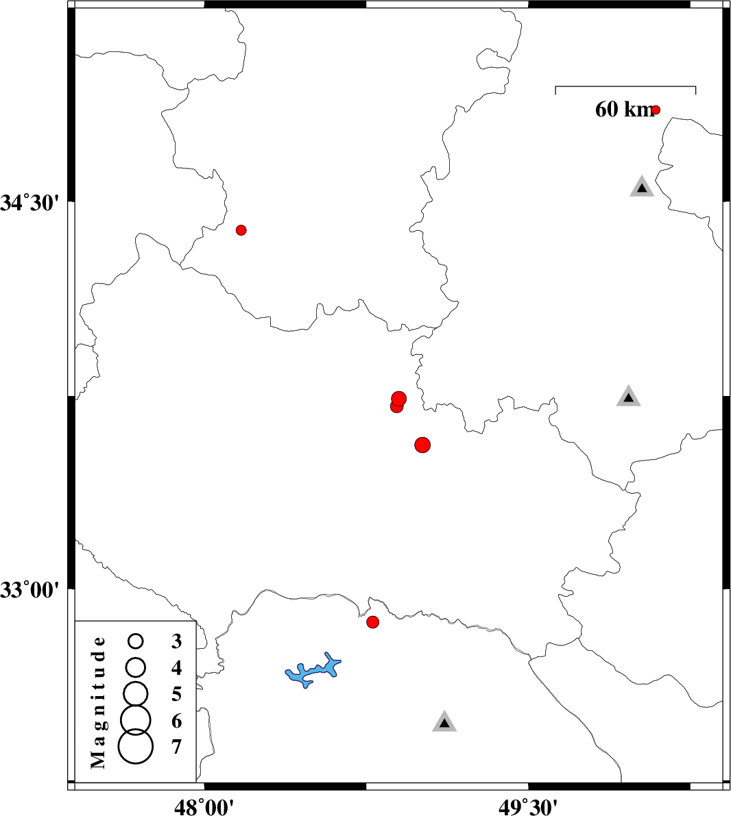
| 2013/03/22 | 13:51:15.7 | 18:21:15.7 | 33.74 | 48.9 | 17 | ML:3.1 | Lorestan Province, 21 km South-East of Borujerd | ||
| 2013/03/21 | 17:01:22.2 | 20:31:22.2 | 32.87 | 48.78 | 14 | ML:2.6 | Khoozestan Province, 61 km North-West of Lali | ||
| 2013/03/21 | 07:23:21.6 | 10:53:21.6 | 32.83 | 47.75 | 14 | ML:3.5 | Ilam Province, 36 km South of Pol-e dokhtar | ||
| 2013/03/20 | 16:53:19.9 | 20:23:19.9 | 34.39 | 48.17 | 14 | ML:2.1 | Hamedan Province, 24 km South-East of Kangavar | ||
| 2013/03/18 | 06:26:24.6 | 09:56:24.6 | 33.56 | 49.01 | 15 | ML:3.3 | Lorestan Province, 10 km Dorud | ||
| 2013/03/16 | 22:47:51.9 | 02:17:51.9 | 34.85 | 50.09 | 22 | ML:1.9 | Markazi Province, 19 km North of Tafresh | ||
| 2013/03/15 | 08:34:40.1 | 12:04:40.1 | 33.71 | 48.89 | 15 | ML:2.7 | Lorestan Province, 24 km South-East of Borujerd |