Home / Recent Earthquakes

| Prel. Rep. | Date | Time(UTC) | Time(Local) | Lat. | Lon. | Depth | Mag. | Region | Waveform |
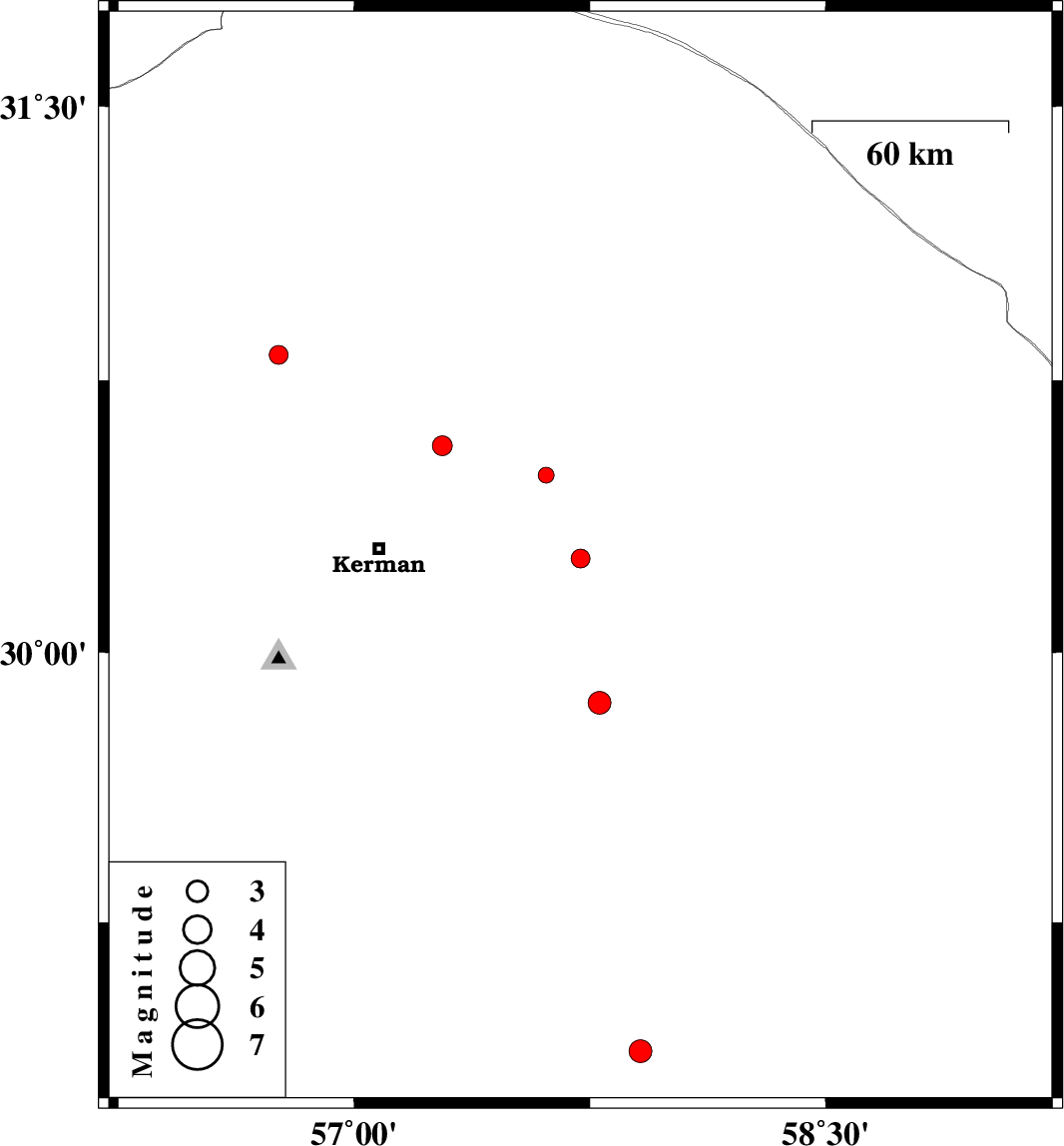
| 2013/04/19 | 22:34:41.4 | 03:04:41.4 | 30.26 | 57.72 | 14 | ML:2.7 | Kerman Province, 61 km East of Kerman | ||
| 2013/04/09 | 06:18:57.7 | 10:48:57.7 | 28.89 | 57.91 | 14 | ML:3.2 | Kerman Province, 30 km North-East of Jiroft | ||
| 2013/04/05 | 10:55:28.2 | 15:25:28.2 | 30.82 | 56.76 | 14 | ML:2.7 | Kerman Province, 18 km East of Zarand | ||
| 2013/03/27 | 12:14:42.4 | 16:44:42.4 | 30.49 | 57.61 | 14 | ML:2.3 | Kerman Province, 56 km North-East of Kerman | ||
| 2013/03/26 | 12:30:42.0 | 17:00:42.0 | 29.86 | 57.78 | 14 | ML:3.3 | Kerman Province, 83 km South-East of Kerman | ||
| 2013/03/23 | 14:09:40.5 | 18:39:40.5 | 30.57 | 57.28 | 16 | ML:2.8 | Kerman Province, 37 km North-East of Kerman |