Home / Recent Earthquakes

| Prel. Rep. | Date | Time(UTC) | Time(Local) | Lat. | Lon. | Depth | Mag. | Region | Waveform |
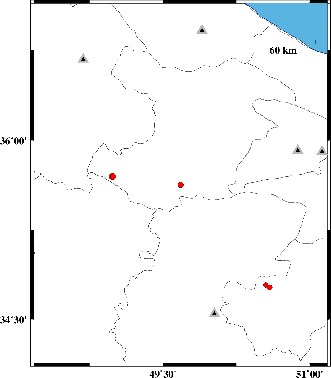
| 2013/05/01 | 02:12:30.5 | 06:42:30.5 | 35.63 | 49.68 | 14 | ML:2.6 | Ghazvin Province, 49 km South of Takestan | ||
| 2013/04/29 | 17:13:51.4 | 21:43:51.4 | 34.79 | 50.55 | 31 | ML:2.2 | Qom Province, 31 km South-East of Saveh | ||
| 2013/04/29 | 16:08:41.3 | 20:38:41.3 | 34.77 | 50.59 | 45 | ML:2.5 | Qom Province, 29 km North-West of Qom | ||
| 2013/04/29 | 06:29:35.7 | 10:59:35.7 | 35.7 | 48.99 | 14 | ML:2.6 | Ghazvin Province, 36 km North of Razan | ||
| 2013/04/29 | 05:56:04.8 | 10:26:04.8 | 35.7 | 48.98 | 14 | ML:2.9 | Ghazvin Province, 36 km North of Razan |