| Prel. Rep. | Date | Time(UTC) | Time(Local) | Lat. | Lon. | Depth | Mag. | Region | Waveform |
|
|
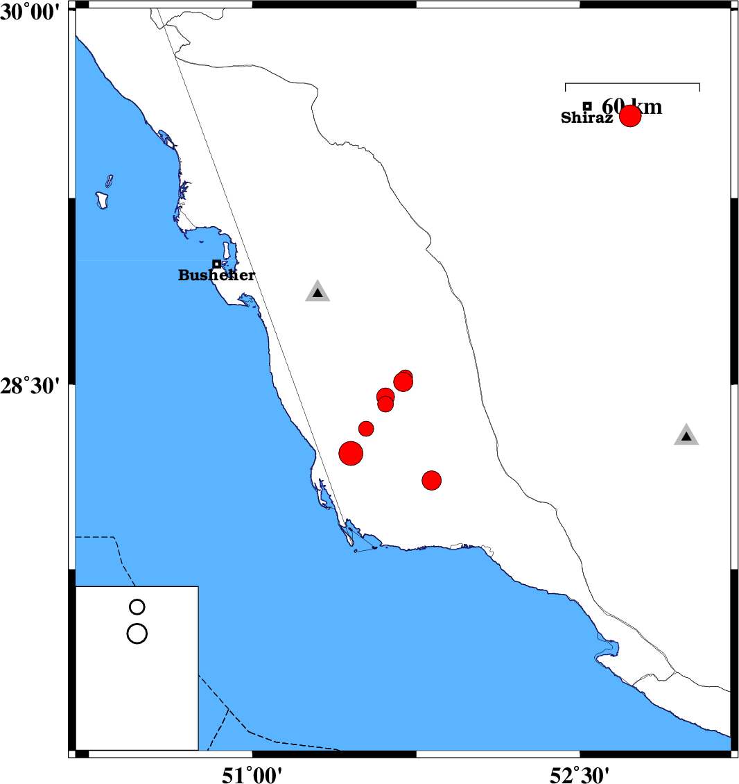
2013/05/16
|
07:16:48.3
|
11:46:48.3
| 28.51 | 51.69 | 14 |
ML:4
|
Bushehr Province, 35 km South-East of Khormog | |
|
|
2013/05/14
|
18:59:36.2
|
23:29:36.2
| 28.53 | 51.7 | 15 |
ML:2.9
|
Bushehr Province, 35 km South-East of Khormog | |
|
|
2013/05/14
|
00:19:50.2
|
04:49:50.2
| 28.32 | 51.52 | 37 |
ML:3.1
|
Bushehr Province, 40 km South-East of Khormog | |
|
|
2013/05/13
|
22:31:12.7
|
03:01:12.7
| 28.42 | 51.61 | 24 |
ML:3.2
|
Bushehr Province, 35 km South-East of Khormog | |
|
|
2013/05/13
|
22:19:14.0
|
02:49:14.0
| 28.22 | 51.45 | 35 |
ML:4.9
|
Bushehr Province, 49 km South of Khormog | |
|
|
2013/05/12
|
22:40:33.4
|
03:10:33.4
| 29.58 | 52.73 | 14 |
ML:4.5
|
Fars Province, 20 km East of Shiraz | |
|
|
2013/05/12
|
02:37:04.3
|
07:07:04.3
| 28.45 | 51.61 | 24 |
ML:3.7
|
Bushehr Province, 32 km South-East of Khormog | |
|
|
2013/05/09
|
03:29:37.2
|
07:59:37.2
| 28.11 | 51.82 | 31 |
ML:4
|
Bushehr Province, 39 km North-West of Bandar-e kangan | |