Home / Recent Earthquakes

| Prel. Rep. | Date | Time(UTC) | Time(Local) | Lat. | Lon. | Depth | Mag. | Region | Waveform |
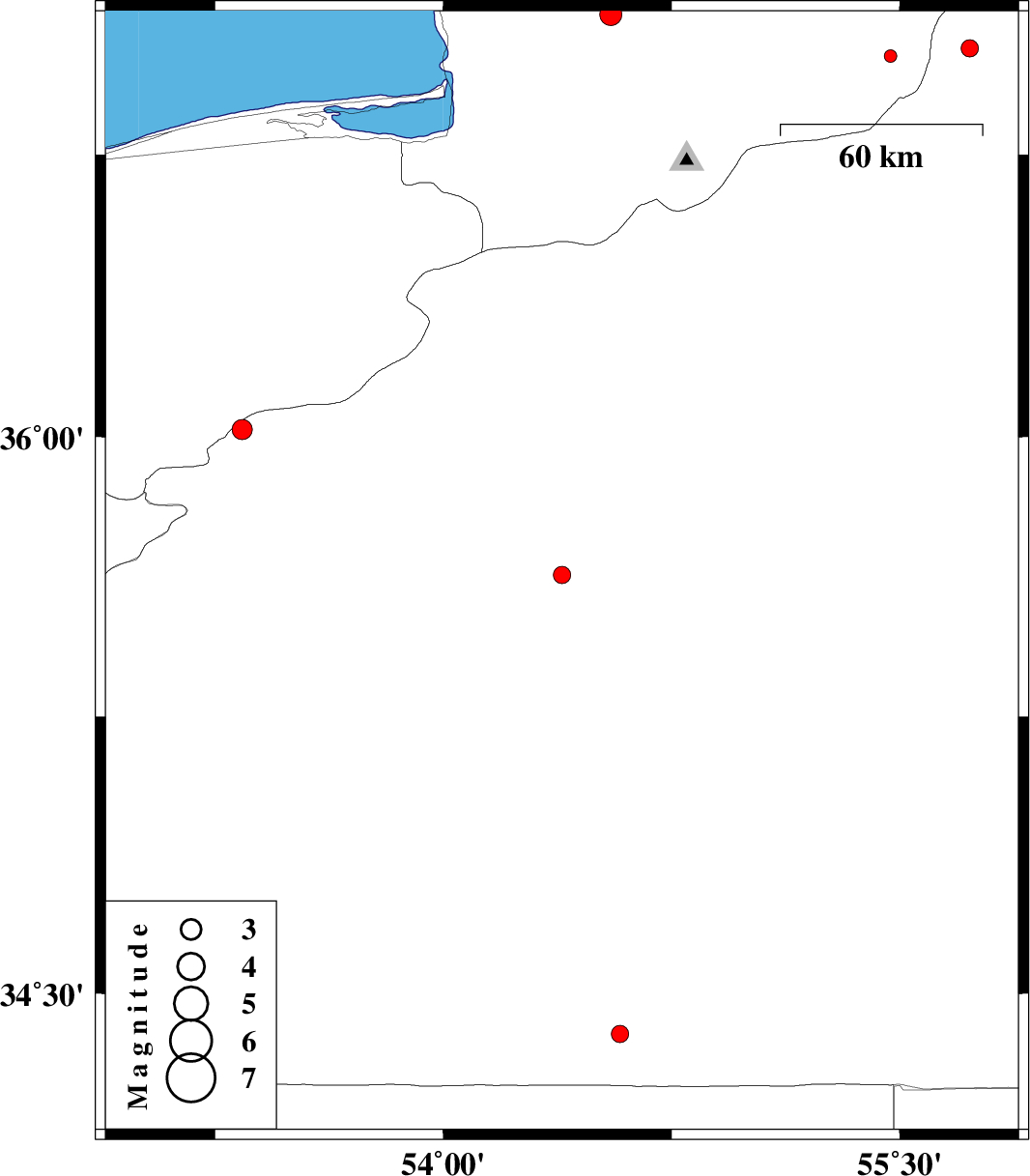
| 2013/06/16 | 04:45:39.4 | 09:15:39.4 | 35.63 | 54.39 | 18 | ML:2.6 | Semnan Province, 59 km South of Damghan | ||
| 2013/06/15 | 02:34:26.0 | 07:04:26.0 | 36.02 | 53.34 | 15 | ML:3 | Semnan Province, 28 km East of Pol-E-Sefid | ||
| 2013/06/02 | 17:37:01.4 | 22:07:01.4 | 34.39 | 54.58 | 14 | ML:2.5 | Semnan Province, 199 km South-East of Damghan | ||
| 2013/06/01 | 15:14:16.0 | 19:44:16.0 | 37.01 | 55.47 | 14 | ML:1.9 | Golestan Province, 26 km South of Minodasht | ||
| 2013/05/24 | 01:52:03.6 | 06:22:03.6 | 37.03 | 55.73 | 16 | ML:2.6 | Semnan Province, 37 km South-East of Minodasht | ||
| 2013/05/21 | 05:30:25.4 | 10:00:25.4 | 37.12 | 54.55 | 18 | ML:3.3 | Golestan Province, 14 km North of Aq Qaleh |