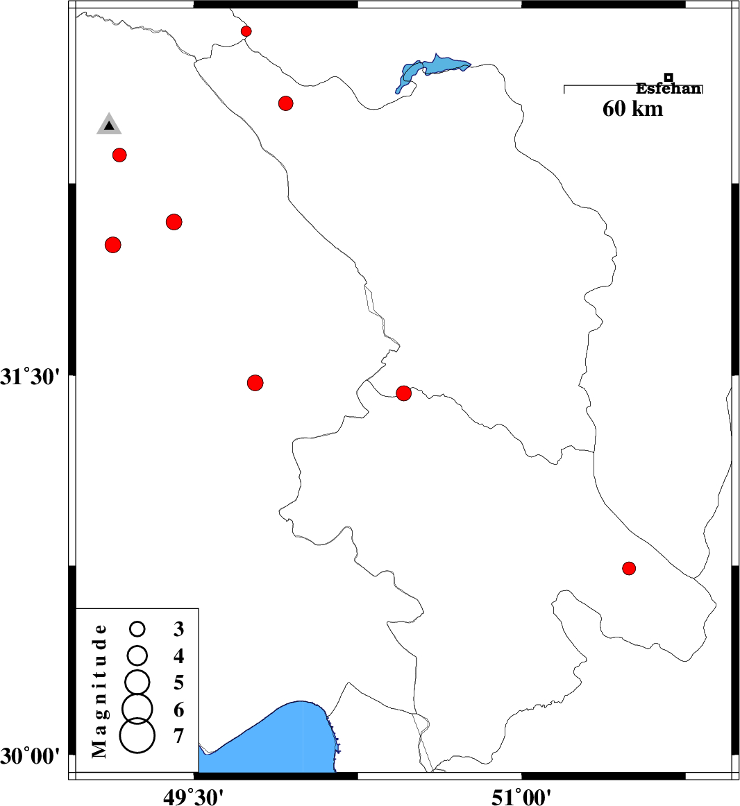
| Prel. Rep. | Date | Time(UTC) | Time(Local) | Lat. | Lon. | Depth | Mag. | Region | Waveform |
|
|
2013/06/23
|
06:37:29.5
|
11:07:29.5
| 31.43 | 50.46 | 16 |
ML:3.1
|
Chaharmahal Bakhtiari Province, 34 km West of Lordegan | |
|
|
2013/06/23
|
00:33:49.3
|
05:03:49.3
| 32.36 | 49.16 | 23 |
ML:2.8
|
Khoozestan Province, 6 km Lali | |
|
|
2013/06/22
|
00:56:45.3
|
05:26:45.3
| 32.56 | 49.92 | 15 |
ML:2.9
|
Chaharmahal Bakhtiari Province, 22 km West of Chelgard | |
|
|
2013/06/17
|
12:45:41.9
|
17:15:41.9
| 32.01 | 49.13 | 27 |
ML:3.2
|
Khoozestan Province, 19 km West of Masjed Soleyman | |
|
|
2013/06/15
|
00:48:15.7
|
05:18:15.7
| 30.74 | 51.49 | 15 |
ML:2.7
|
Kohkiluieh va boyerahmad Province, 11 km Yasuj | |
|
|
2013/06/12
|
19:26:48.0
|
23:56:48.0
| 31.47 | 49.78 | 14 |
ML:3.3
|
Khoozestan Province, 12 km West of Bagh Malek | |
|
|
2013/06/07
|
00:20:49.0
|
04:50:49.0
| 32.84 | 49.74 | 6 |
ML:2.1
|
Lorestan Province, 36 km West of Fereydunshahr | |
|
|
2013/06/03
|
21:11:03.4
|
01:41:03.4
| 32.1 | 49.41 | 14 |
ML:3.2
|
Khoozestan Province, 21 km North-East of Masjed Soleyman | |