| Prel. Rep. | Date | Time(UTC) | Time(Local) | Lat. | Lon. | Depth | Mag. | Region | Waveform |
|
|
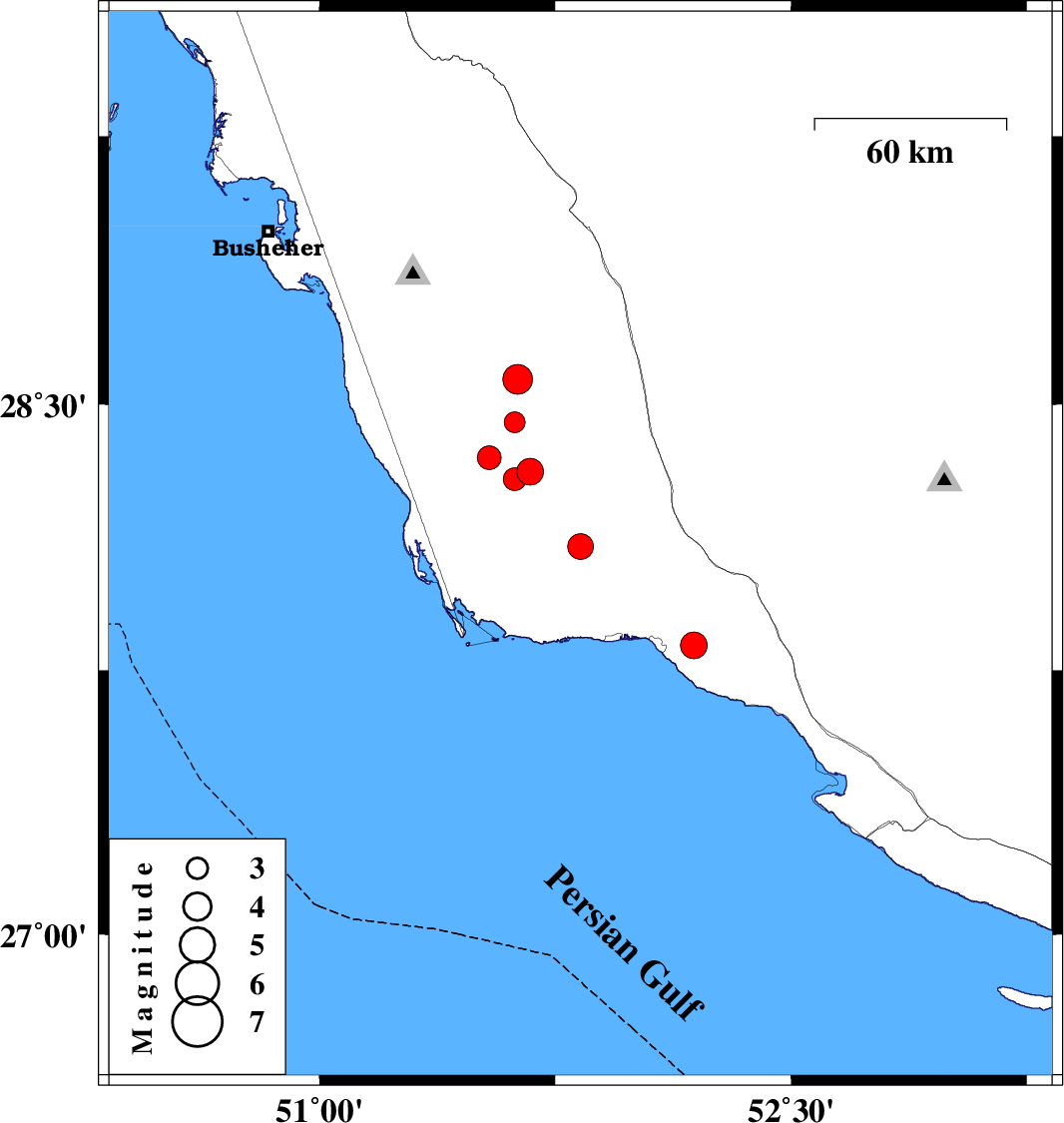
2013/08/04
|
03:53:47.8
|
08:23:47.8
| 28.1 | 51.83 | 32 |
ML:3.6
|
Bushehr Province, 38 km North-West of Bandar-e kangan | |
|
|
2013/08/03
|
17:39:46.7
|
22:09:46.7
| 28.31 | 51.67 | 36 |
ML:3.8
|
Bushehr Province, 48 km South-East of Khormog | |
|
|
2013/08/03
|
13:21:36.6
|
17:51:36.6
| 27.82 | 52.19 | 35 |
ML:3.8
|
Bushehr Province, 13 km East of Bandar-e kangan | |
|
|
2013/07/31
|
01:04:44.1
|
05:34:44.1
| 28.45 | 51.62 | 47 |
ML:3
|
Bushehr Province, 33 km South-East of Khormog | |
|
|
2013/07/26
|
12:44:44.8
|
17:14:44.8
| 28.35 | 51.54 | 27 |
ML:3.4
|
Bushehr Province, 37 km South-East of Khormog | |
|
|
2013/07/24
|
11:58:38.1
|
16:28:38.1
| 28.57 | 51.63 | 21 |
ML:4.2
|
Bushehr Province, 27 km East of Khormog | |
|
|
2013/07/09
|
03:50:59.1
|
08:20:59.1
| 28.29 | 51.62 | 28 |
ML:3.3
|
Bushehr Province, 47 km South-East of Khormog | |