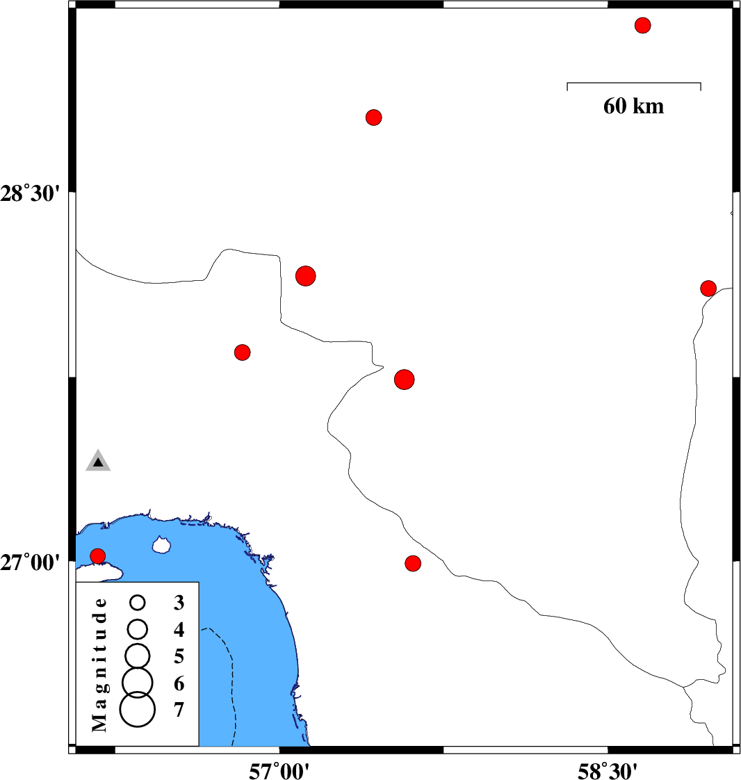
| Prel. Rep. | Date | Time(UTC) | Time(Local) | Lat. | Lon. | Depth | Mag. | Region | Waveform |
|
|
2013/09/25
|
16:18:37.2
|
19:48:37.2
| 27.74 | 57.57 | 14 |
ML:4.1
|
Kerman Province, 27 km South-West of Kahnuj | |
|
|
2013/09/24
|
04:43:26.9
|
08:13:26.9
| 28.8 | 57.43 | 15 |
ML:3.2
|
Kerman Province, 34 km North-West of Jiroft | |
|
|
2013/09/22
|
23:13:36.4
|
02:43:36.4
| 28.11 | 58.96 | 18 |
ML:3.3
|
Kerman Province, 125 km North-East of Kahnuj | |
|
|
2013/09/21
|
06:27:33.9
|
10:57:33.9
| 28.16 | 57.12 | 14 |
ML:4.1
|
Kerman Province, 61 km North-West of Kahnuj | |
|
|
2013/09/17
|
17:28:18.4
|
21:58:18.4
| 27.02 | 56.17 | 15 |
ML:3.1
|
Persian Gulf, 12 km Qeshm | |
|
|
2013/09/05
|
02:59:06.9
|
07:29:06.9
| 27.85 | 56.83 | 14 |
ML:3.3
|
Hormozgan Province, 62 km North-West of Dehbarez | |
|
|
2013/09/02
|
00:36:10.3
|
05:06:10.3
| 29.17 | 58.66 | 14 |
ML:3.2
|
Kerman Province, 31 km East of Bam | |
|
|
2013/08/26
|
12:40:50.9
|
17:10:50.9
| 26.99 | 57.61 | 14 |
ML:3.3
|
Hormozgan Province, 48 km South-East of Manujan | |